RÍOS / ARAGUAIA
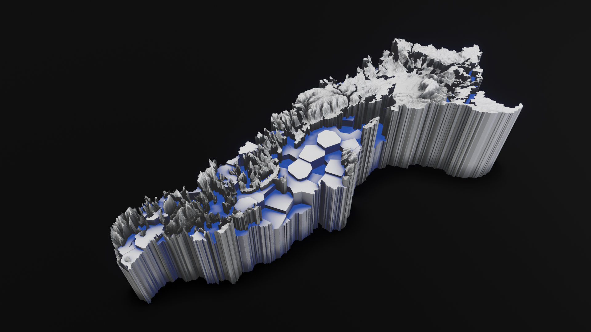
Araguaia + socio-environmental threatsTechnique: 3D printed porcelain
Dimensions: 218mm x 91.4mm x 362mm (before baking, dimensions vary after baking process)
Scale 1: 1,400,000
Limited edition: 3 copies + Artist proof
The digital elevation models used to generate the volumetric cartographic representations are based on topographic data combined with statistical data and geospatial socio-environmental information formulated by the RAISG (Amazon Geo-Referenced Socio-Environmental Information Network).
The geo-referenced information is associated with the linguistic analysis carried out by the online application Rivers // Amazonia geo-linguistic: https://rivers.ulara.org
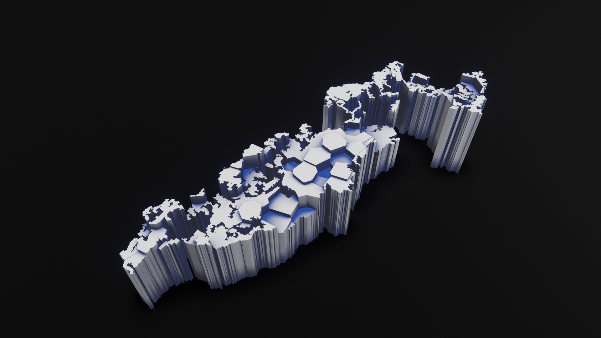
The results of this analysis are applied to the geo-referenced marks where socio-environmental threats have been identified, by carrying out experimental interventions on the real topographic data of the Amazonian territory.
Based on the Araguaia Amazons sub-basin, stamped the 19th of June 2021 with data analysis performed by Rivers // Amazonia geo-linguistic.
The following hashtag associations were recorded to produce the sculpture:
climatecrisis, natureza, pantanal, deforestation, brazil, mining, keepitintheground, investors, staking, native, actuators, meat, biodiversity, altcoin, coal, biden, amazonrainforest, amazon, infrastructure, commodities, forest, packaging, goldstocks, electrical, humanrights, pollution, vergecurrency, water, nature, pool, binance, software, pauto, amazonia, climateaction, stocks, energy, investing, sustainability, forests, copper, stock, indigenous, climateemergency, actonclimate, blockchain, manufacturers, juniormining, oil, resources, renewables, instrumentation, minerals, environmental, economy, invest, pandemic, finance, shale, subsea, markets, oilandgas, togetherforests, wildlife, trading, business, mineria, drilling, petroleum, investment, offshore, rivers, exploration, deve, future, scrypt, climate, tiredearth, ecocide, oldgrowth, logging, news, globalwarming, indigenas, bolsonaro, welding, metals, oilprice, crypto, gas, nickel, engineering, conservation, renewableenergy, brasil, climatechange, soil, investor, economics, industrial, manufacturing, power, extinction, technology, oott, agriculture, btc, gold, valves, bcpoli, ethereum, shalegas, silver, jbs, rainforest, genocide, manaus, environment, desmatamento, crudeoil, construction, auspol, preciousmetals, hydraulic, cryptocurrency, health, fracking, drillrig, cdnpoli, gojira, pahrmaceuticals, pneumatic, tech, amazonas, meioambiente, akrdc, bitcoin, oilandgasindustry, defi, oilfield, gaskets, palmoil, wildfires, cerrado, onshore, fintwit, bnp, beef, trees, sustainable.
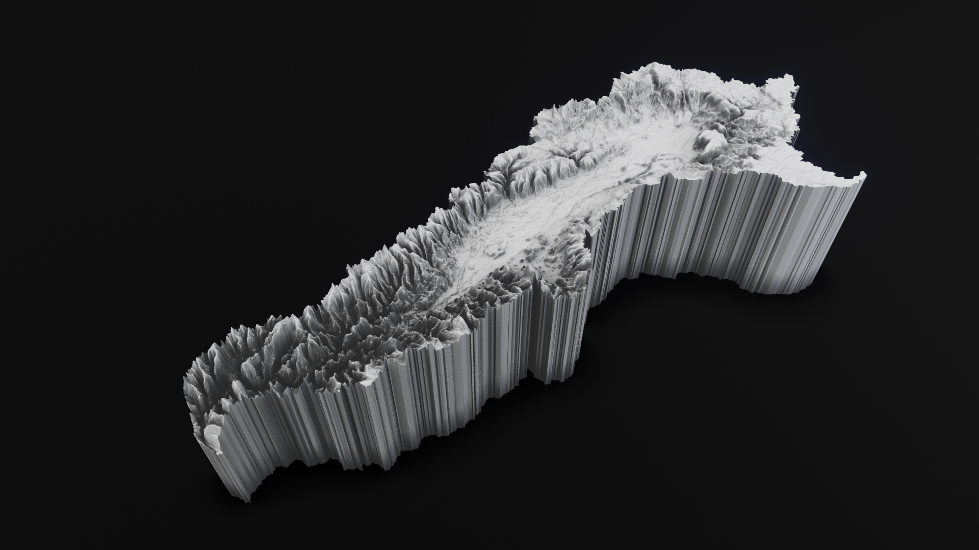
The Araguaia-Tocantins is the easternmost large tributary in the Amazon Basin. With more than 750.000 km2, the Araguaia-Tocantins Basin is more than twice the size of Ecuador and larger than France. It is the largest river valley restricted to one country in the Amazon Basin.
The relief is considered a monotype, with altitudes varying between 350m and 500m, except in the river springs, where it reaches more than 1.000m. In the Tucuruí region, altitudes are less than 10m. The Araguaia-Tocantins basin is the second largest in energy production in Brazil.
Protected Areas
Araguaia National Park, which now covers the northern third of Bananal Island, was the first national park decreed in the Brazilian Amazon. It is the only major conservation unit protecting wetlands in the Tocantins Basin and is probably Brazil's best hope for protecting wildlife associated with savanna wetlands. There are also relatively large contiguous indigenous areas near the Araguaia National Park.
Uses & Impacts
The Tocantins River is the most heavily modified large tributary of the Amazon Basin. By the early 1970s, the Belém-Brasília and Trans-Amazonian highways opened the Tocantins Basin to large-scale development. Cattle ranching expanded along the major highways and led to extensive deforestation in the states of Goiás, Tocantins and Pará. In the 1990s, the soybean-farming frontier pushed north into the Cerrado and rainforest areas of Goiás and Tocantins states. The world's largest high-grade iron ore deposits are in the Carajás region in the Itacaiunas sub-basin in the lower Tocantins Basin. Manganese, copper, gold and other minerals are also exploited in the Carajás region. Manganese and copper are mined in the region and transported by rail to the port of Itaqui, in the state of Maranhão.
Currently, the Araguaia-Tocantins Basin produces more hydroelectric energy than any other basin in the Amazon. More than 20 dams have been planned for the Tocantins and Araguaia Rivers. An enormous electrical distribution network already exists that serves the eastern and central Amazon Basin of Brazil and northeastern and central Brazil.
The Cerrado region of Central Brazil covers much of the headwater regions of the Tocantins, Xingu and Tapajós Rivers. In the past four to five decades, thousands of streams have been destroyed in the region as the cattle ranching, and agricultural frontiers advanced northward. Once the riparian forest is destroyed, streams are subject to complete desiccation during the dry season. One of the characteristic aquatic habitats of the cerrado region is the buriti (Mauritia flexuosa) palm swamp, which occupies low-lying areas along streams. Hundreds of shade-loving animal species depend on these aquatic forests in an otherwise precarious desert-like environment during the dry season. Palm swamps are rapidly disappearing due to stream impoundment, brush fires in exceptionally dry years and aggressive deforestation of riparian vegetation. Urgent regulations are needed to preserve at least riparian forest in large-scale agricultural areas not only for terrestrial and aquatic wildlife but also to help maintain water quality.
Large and small dams, mining, cattle ranching, road construction and large-scale crop farming for soybeans will continue to transform the Araguaia-Tocantins Basin. Industries will be attracted as hydroelectric projects make more energy available. A functional interstate river basin commission has yet to be fully implemented to assess the long-term and far-reaching consequences of headwater deforestation, dam construction, pesticide pollution and other activities that can cause significant downstream impacts. As development continues, most of the middle and upper Araguaia-Tocantins Basin will gradually be transformed into a drier, non-forested landscape.
For complete information about socio-environmental threats, follow this link:
https://atlas2020.amazoniasocioambiental.org/en/posts/introduction
Sources:
http://amazonwaters.org/
https://www.amazoniasocioambiental.org


