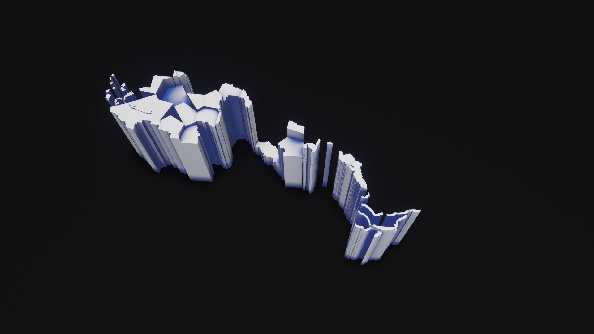
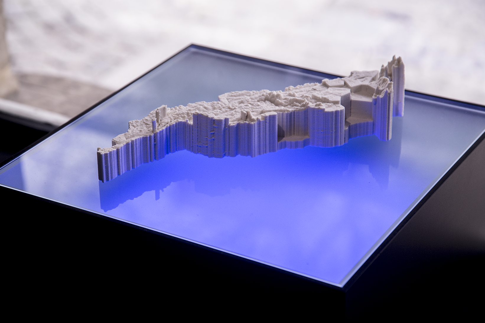
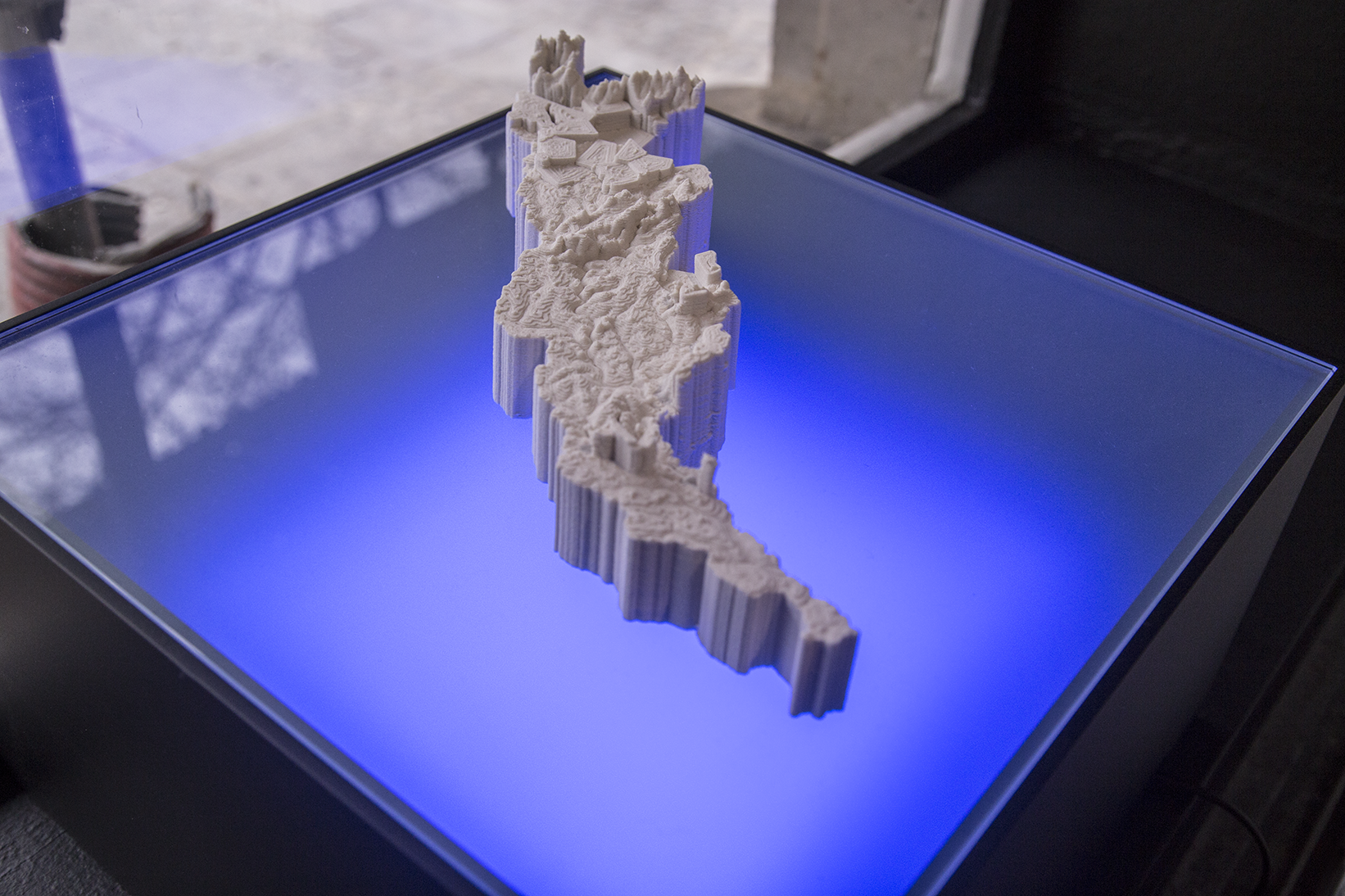
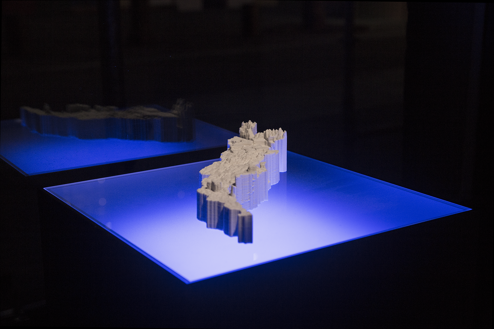
RÍOS / JAPURÁ-CAQUETÁ
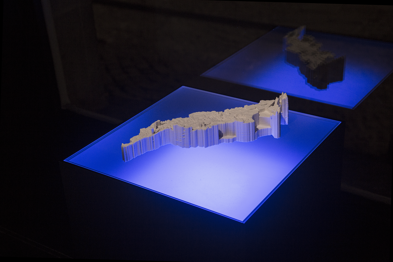
Japurá-Caquetá + socio-environmental threatsTechnique: 3D printed porcelain
Dimensions: 200mm x 390mm x 86.6mm (before baking, dimensions vary after the baking process)
Scale 1: 1,400,000
Limited edition: 3 copies + Artist proof
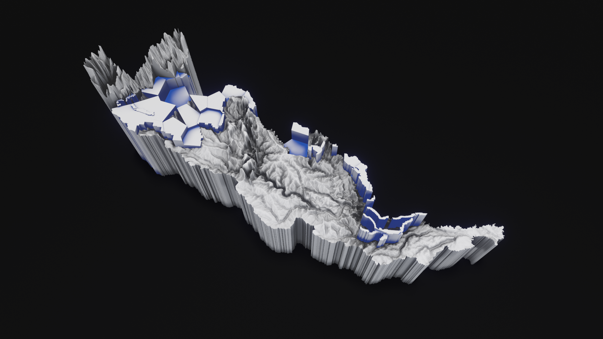
The digital elevation models used to generate the volumetric cartographic representations are based on topographic data combined with statistical data and geospatial socio-environmental information formulated by the RAISG (Amazon Geo-Referenced Socio-Environmental Information Network).
The geo-referenced information is associated with the linguistic analysis carried out by the online application Rivers // Amazonia geo-linguistic: https://rivers.ulara.org
The results of this analysis are applied to the geo-referenced marks where socio-environmental threats have been identified, by carrying out experimental interventions on the real topographic data of the Amazonian territory.
Based on the Caquetá-Japurá Amazons sub-basin, stamped the 4th of December 2020 with data analysis performed by Rivers // Amazonia geo-linguistic.
The following hashtag associations were recorded to produce the sculpture:
amazonia, amazons, caqueta, japura, mineria, crypto, jewelry, goldprice, blockchain, binance, minerals, investor, gold, stockstobuy, finance, diamante, mining, preciousmetals, oil, stock, copper, prstani, stockstowatch, bitcoin, construction, whitegold, geology, amazonia, rings, stocks, news, fintwit, investors, oro, goldrings, goldsmith, nickel, investment, goldstocks, diamant, btc, vergecurrency, diamond, miningstock, ironore, diamonds, scrypt, drilling, business, staking, investments, brasil, plata, tsxv, coin, zlato, lithium, golden, defi, porocniprstani, uranium, cobre, zinc, metals, resources, exploration, coal, wedding, altcoin, deve, commodities, future, invest, basemetals, juniormining, ethereum, energy, trading, silver, miningnews, cobalt, silverprice, palladium, cryptocurrency, pool, markets, money, mineralexploration, belozlato, biden, goldmining, investing, platinum, natgas, crude, kelistrikan, crudeoil, environment, infrastructure, oilandgas, wind, fintwit, cleanenergy, naturalgas, lng, amazons, oilandgasindustry, economics, renewables, petroleum, oott, business, biden, refining, politics, energyefficiency, software, fracking, tambang, storage, environmental, hydropower, carbon, deforestation, electricity, climate, nuclear, coal, energy, frackingchallenge, oilfield, water, solarpower, climatecrisis, commodities, agriculture, drillrig, minerals, markets, solar, shalegas, exploration, bigdata, fossilfuels, oilgas, oil, pipeline, power, renewable, onshore, technology, economy, renewableenergy, climateaction, construction, gas, solarenergy, drilling, investing, geothermal, listrik, emissions, finance, auspol, marketing, shale, fuels, oilindustry, offshore, innovation, forex, sustainability, subsea, transportation, trading, climatechange, stocks.
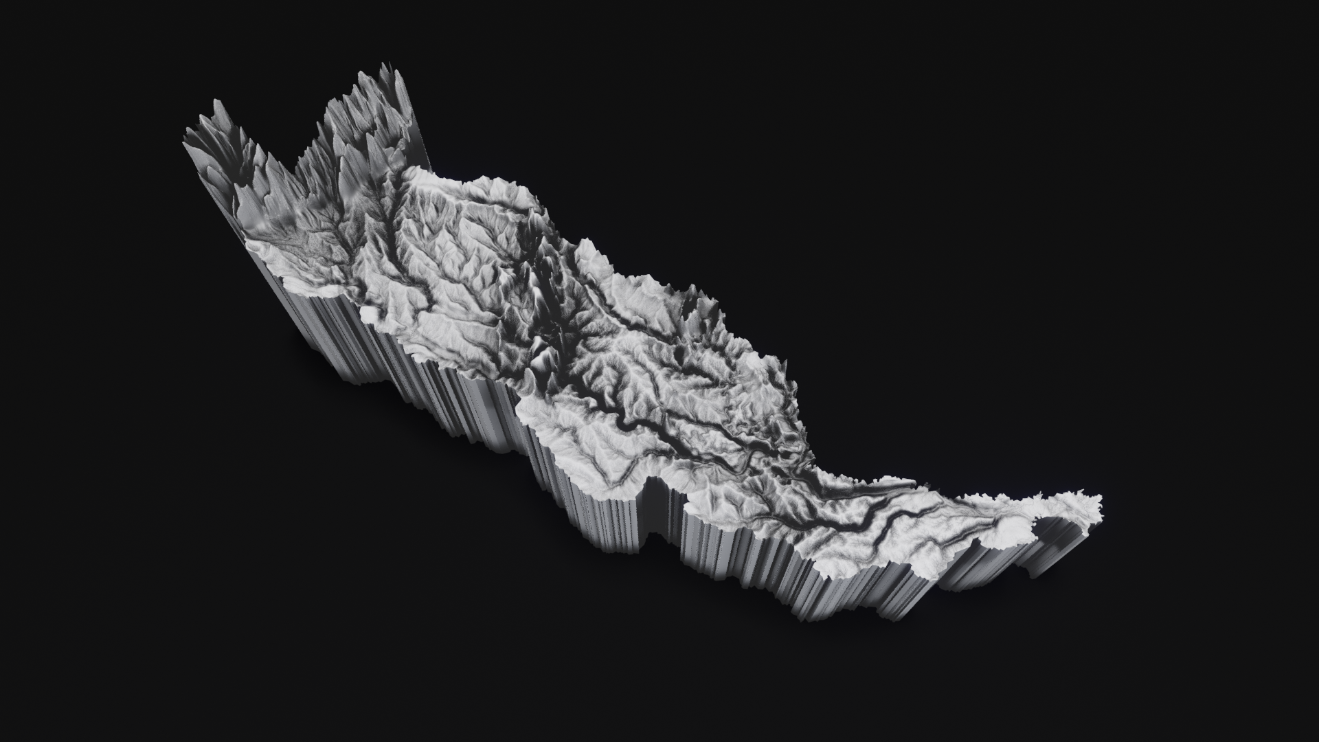

The Caquetá-Japurá Basin occupies approximately 253.000 km2, about 3.7% of the Amazon Basin. It is the ninth-largest tributary basin in the Amazon is located in Colombia and Brazil. The Caquetá-Japurá River is approximately 2.800 km long and is the fourth-longest tributary of the Amazon River. About two-thirds of the tributary is in Colombia, where it is known as the Caquetá. The other one-third is in Brazil, where it is called the Japurá.
The headwaters of the Caquetá-Japurá are nearly 5.000 km from the Amazon River mouth and arise in the Cordillera Oriental of Colombia, which is less than 100 km from the upper Magdalena Basin and is only about 250 km south of Bogotá. The Caquetá-Japurá is a turbid river with numerous blackwater and clearwater tributaries that arise largely in the lowlands. The Apaporis River, whose confluence with the Caquetá is at the Colombian-Brazilian border, is the largest blackwater tributary. It is famous for its strikingly beautiful waterfalls and rapids. The Caquetá River meanders around broad curves for most of its length, and there are some extensive floodplains. The lower 200 km of the Japurá River join with the Amazon River (Solimões) floodplain to form one of the largest wetlands in the Amazon dominated by flooded forest, where is located the Mamirauá Sustainable Development Reserve in Brazil.
Indigenous groups dominate the sparse population of most of the Caquetá-Japurá Basin. With more than 100.000 residents, Florencia is the most populous city in the valley and is the capital of the department of Caquetá. Araracuara, with approximately 30.000 residents, is the largest city in the middle of Caquetá Basin.
Protected Areas
The upper and middle Caquetá Basin was largely controlled by Colombian guerrilla forces and currently by drug traffickers and paramilitaries. Indigenous groups inhabit most of the middle and lower Caquetá Basin. There are two large protected areas in the region: Chiribiquete National Park in the Andean foothill region and Cahuinari National Park near the Brazilian border.
Uses & Impacts
Caquetá-Japurá headwaters are among the most deforested of any large basin in the western Amazon. Besides cattle ranching, coca has also been a major economic activity that has led to deforestation. Colonized areas farther downstream include Araracuara, Puerto Santander and La Pedrera in the middle Caquetá. The major roads into the Caquetá Basin are restricted to the foothill region. However, Bogotá is connected to Chiribiquete National Park in the department of Caquetá by a road that crosses the Colombian departments of Meta and Guaviare. The floodplains of the lower Japurá and the adjoining Solimões have been extensively logged for several decades. Brazilian gold miners have explored the region near the Brazilian-Colombian border for alluvial-gold deposits. The total area accumulated area of deforestation (until 2018) is: 733,490.58 ha.
For complete information about socio-environmental threats, follow this link:
https://atlas2020.amazoniasocioambiental.org/en/posts/introduction
Sources:
http://amazonwaters.org/
https://www.amazoniasocioambiental.org