RÍOS // CHAPTER N.2
RÍOS // CHAPTER N.2 - 2023
HYBRID CARTOGRAPHIES
For general information about the project: Rios Trilogy
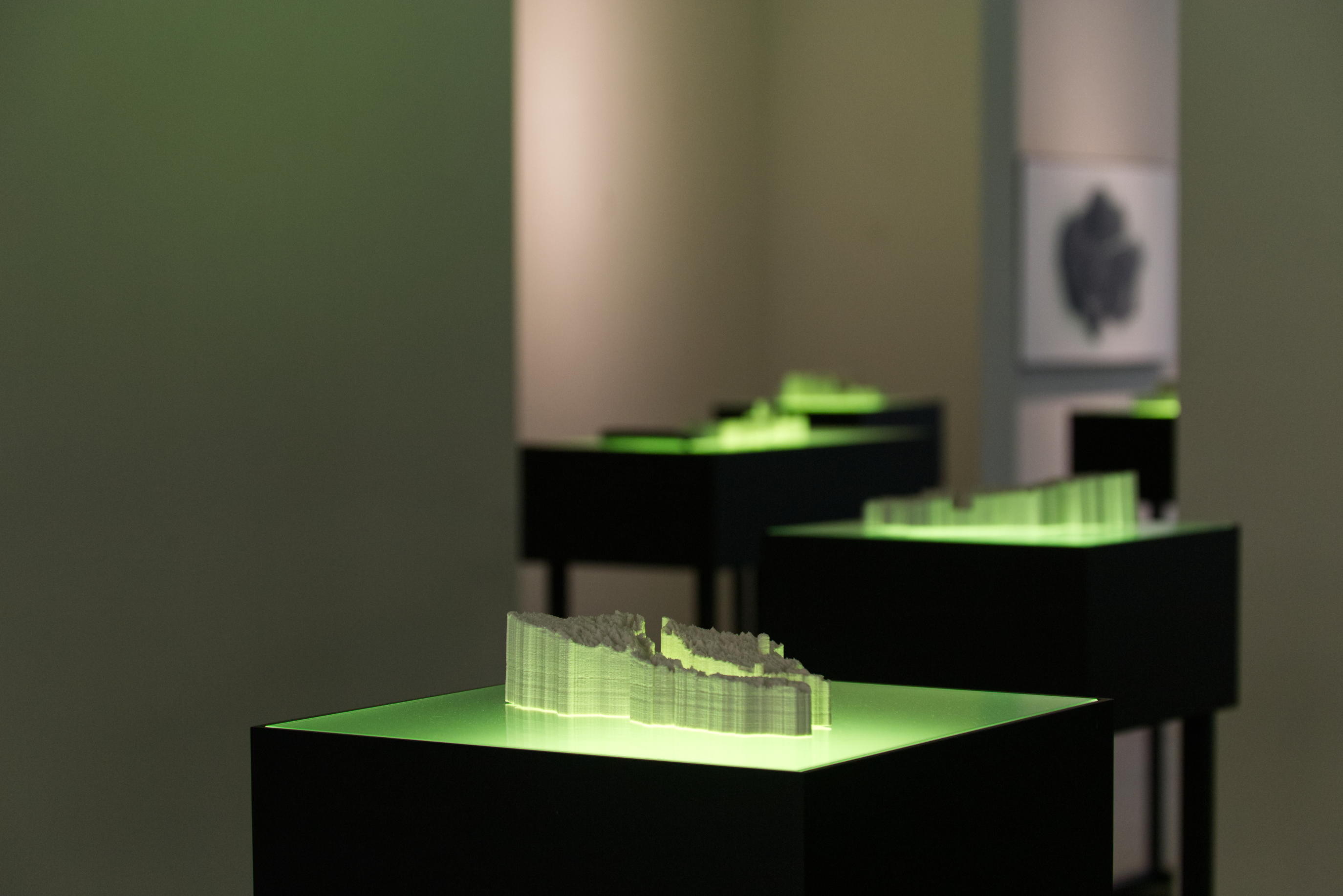
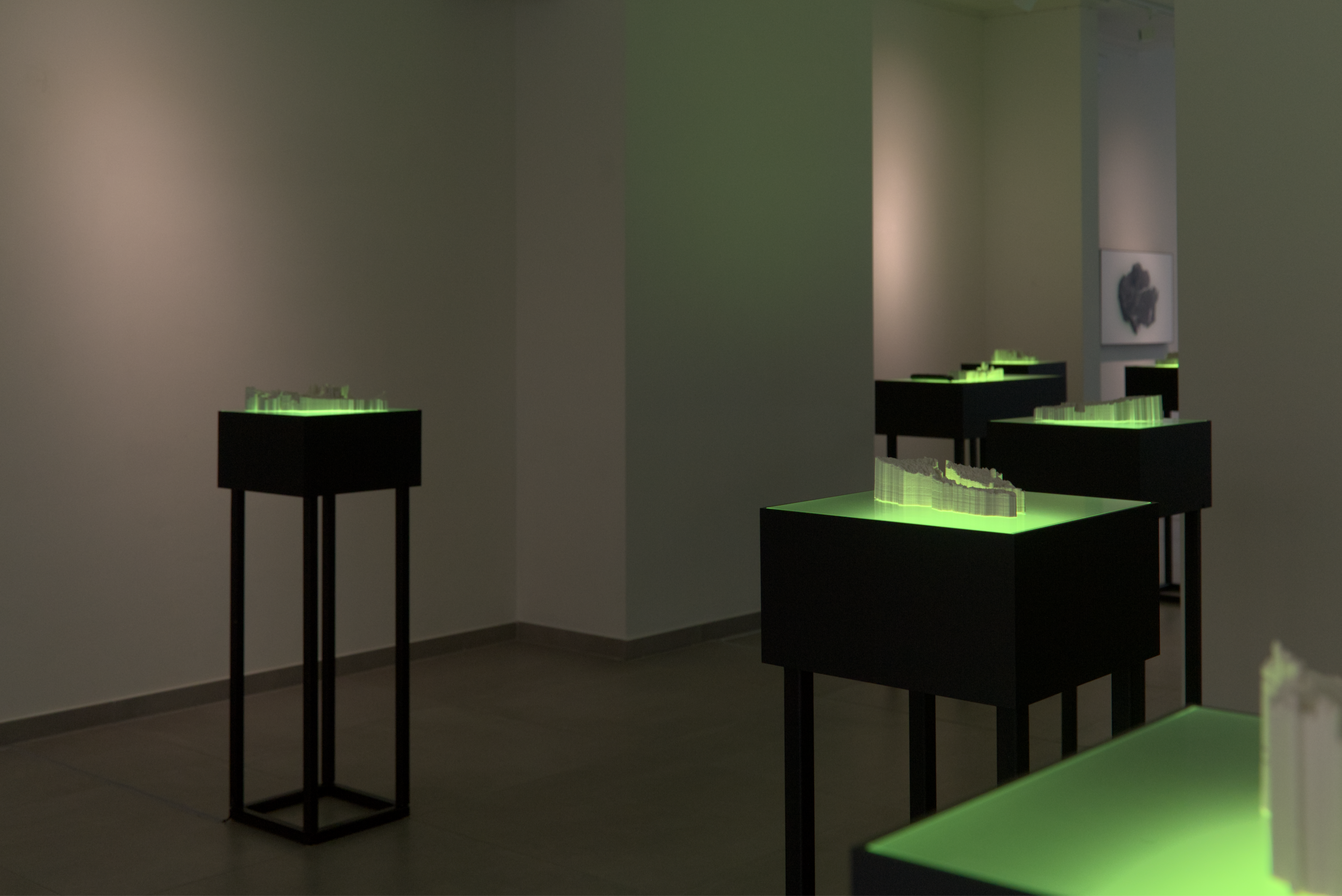
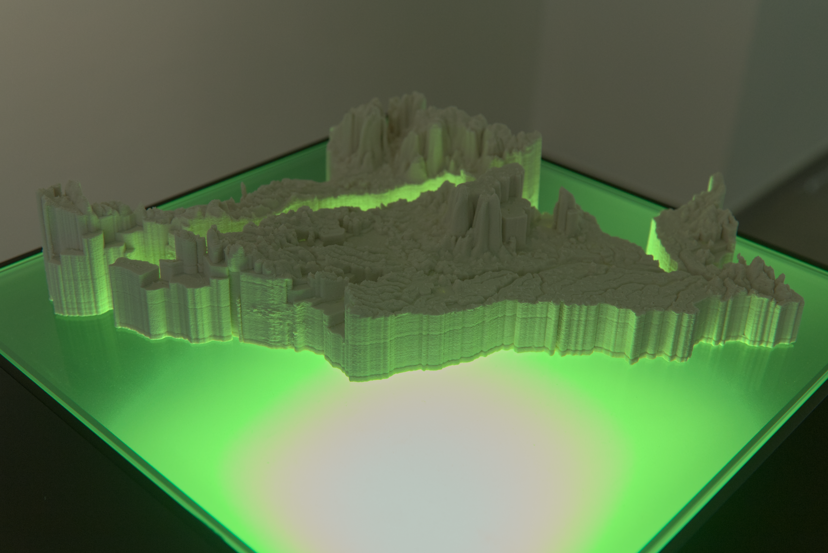
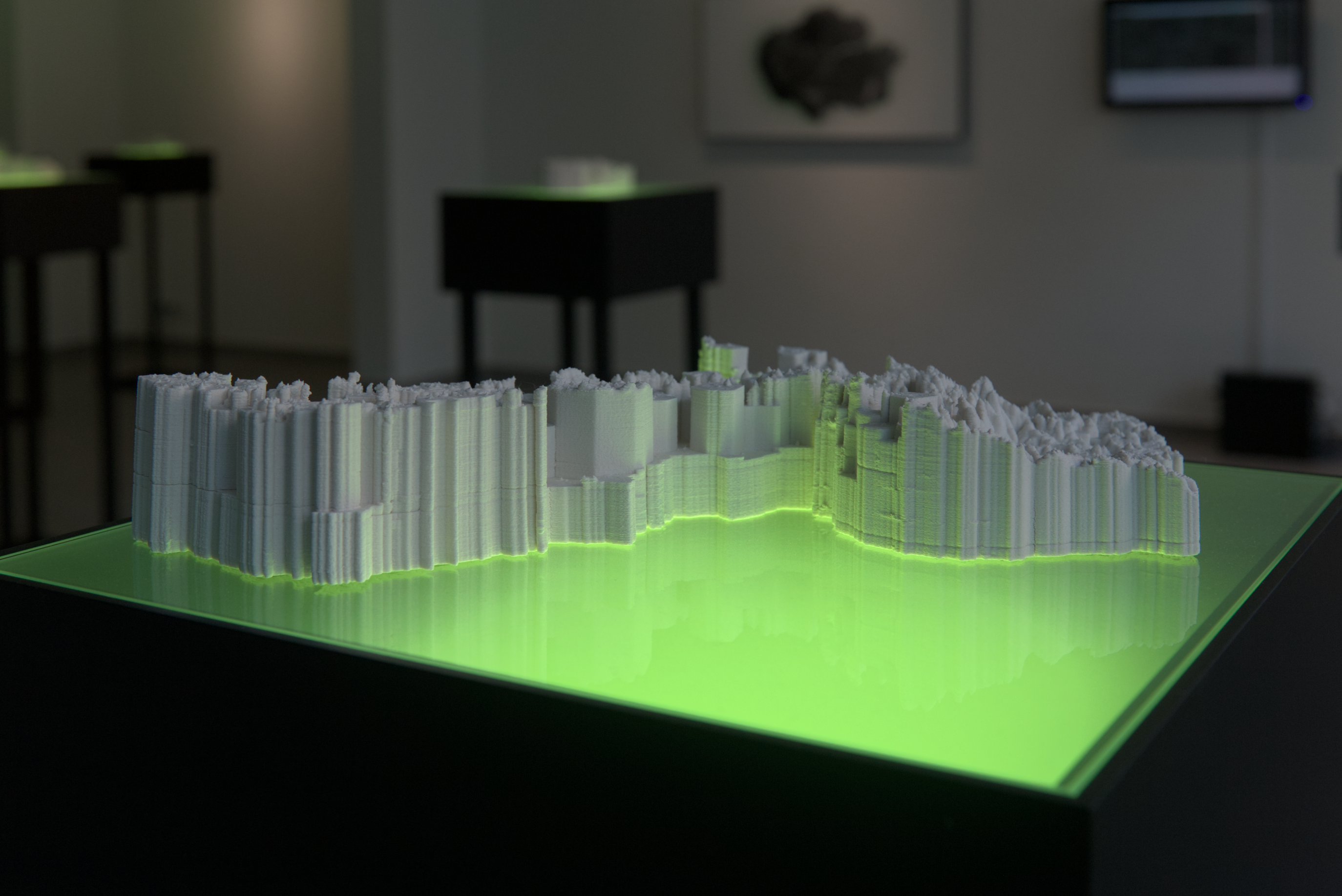
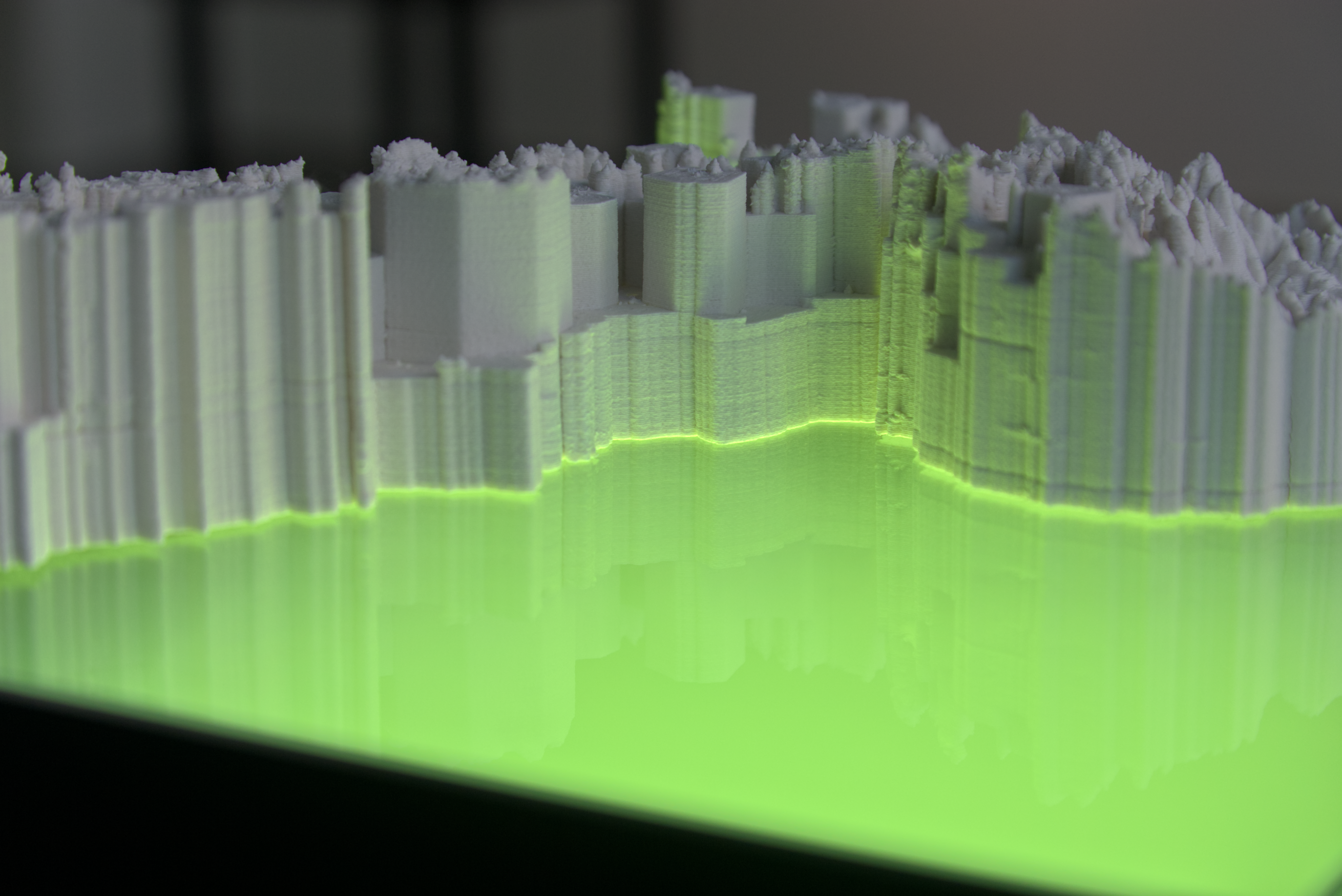
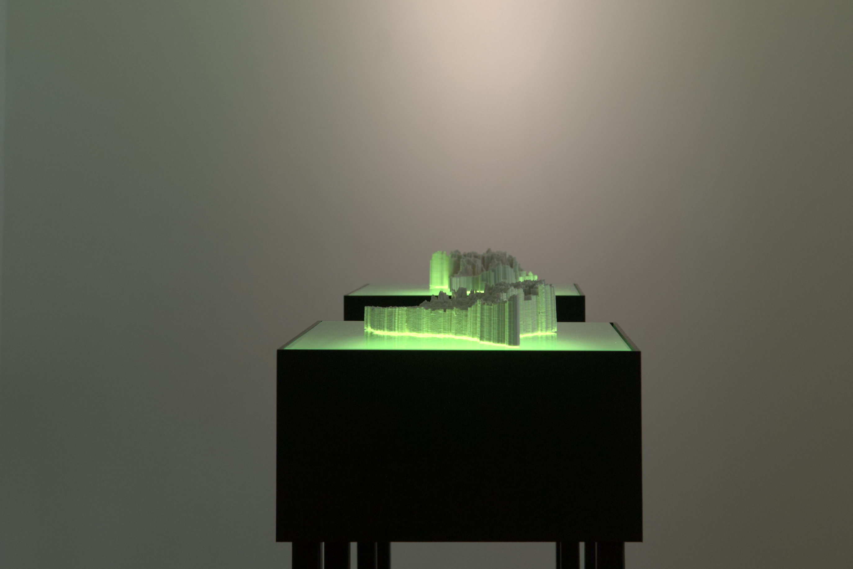
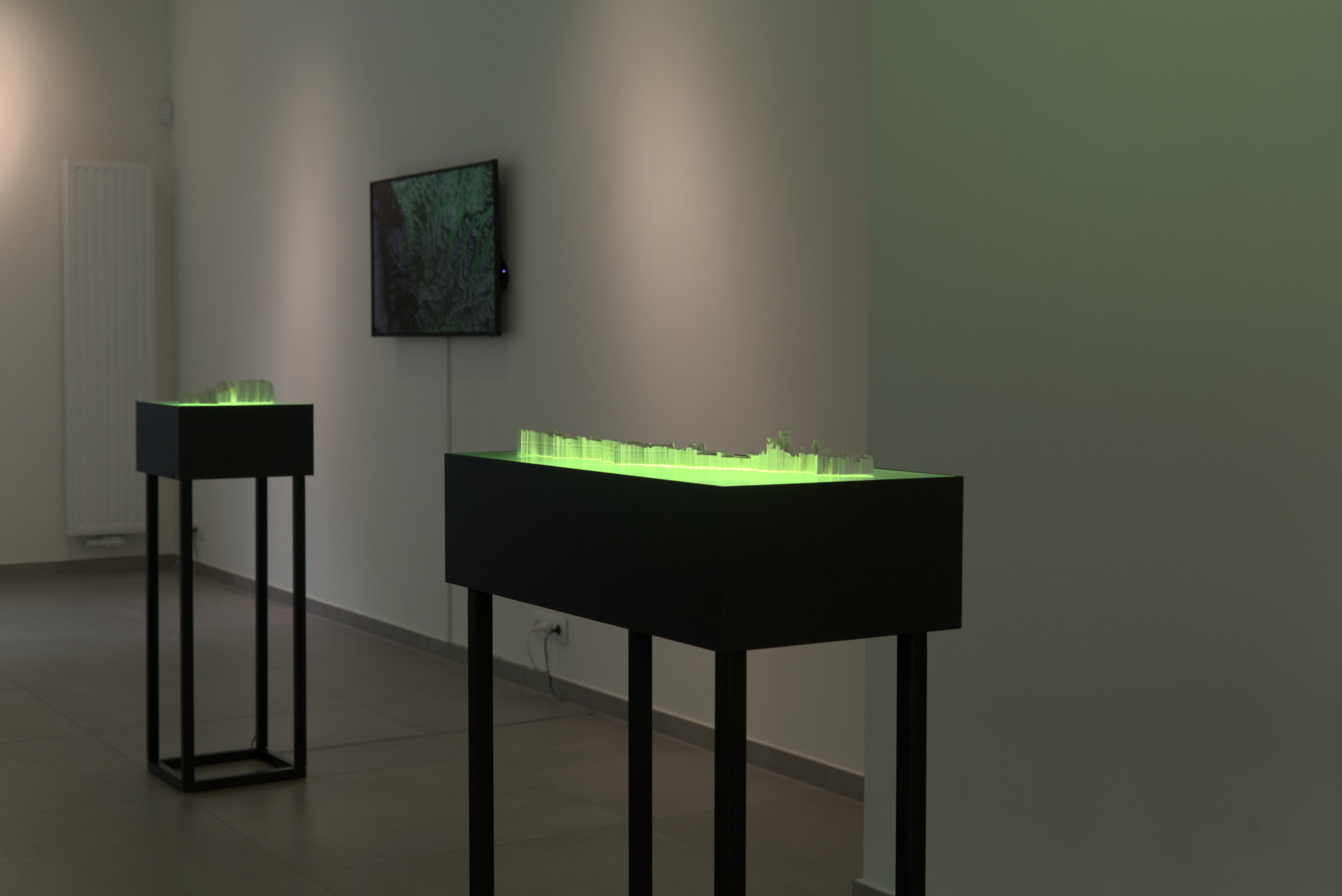
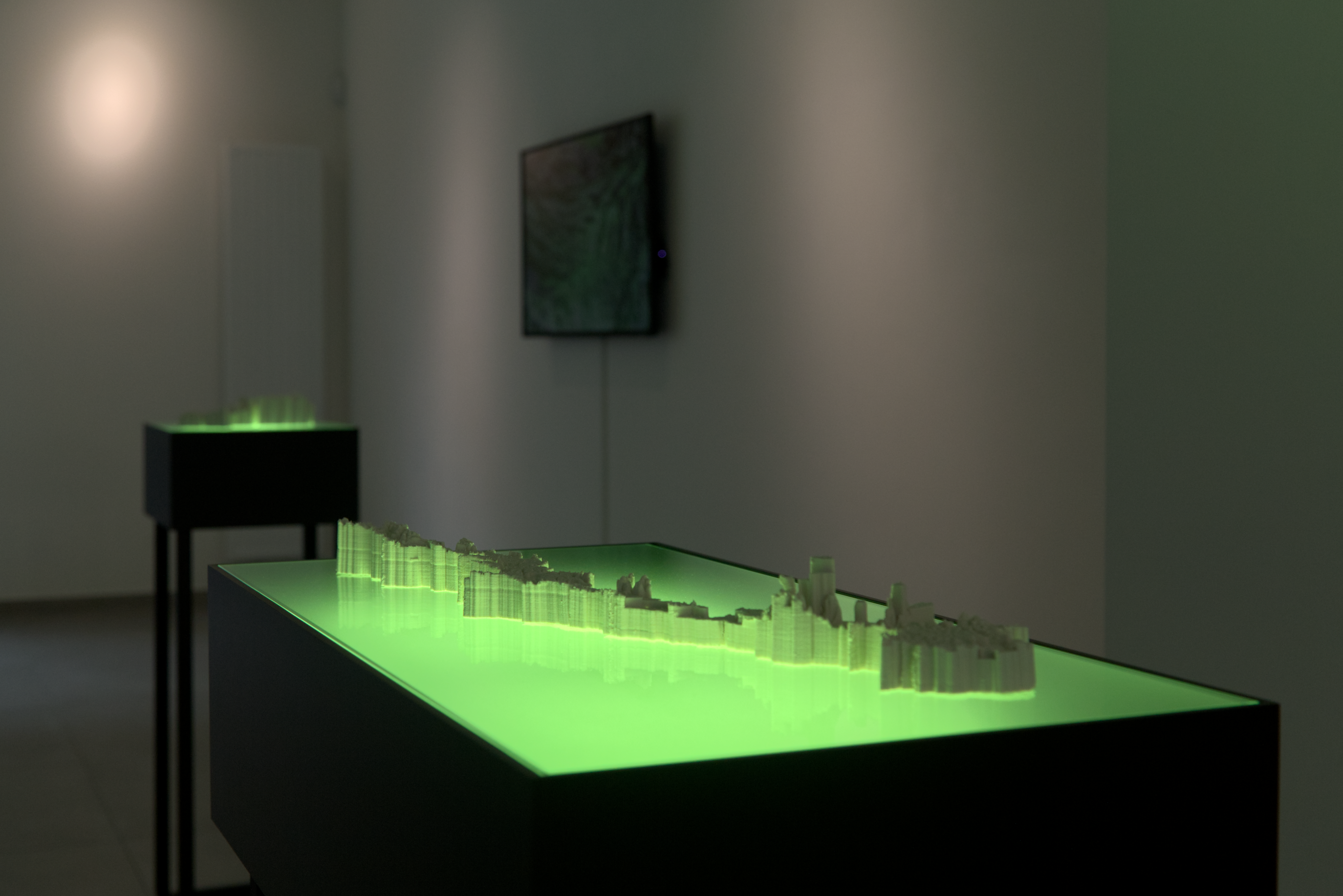
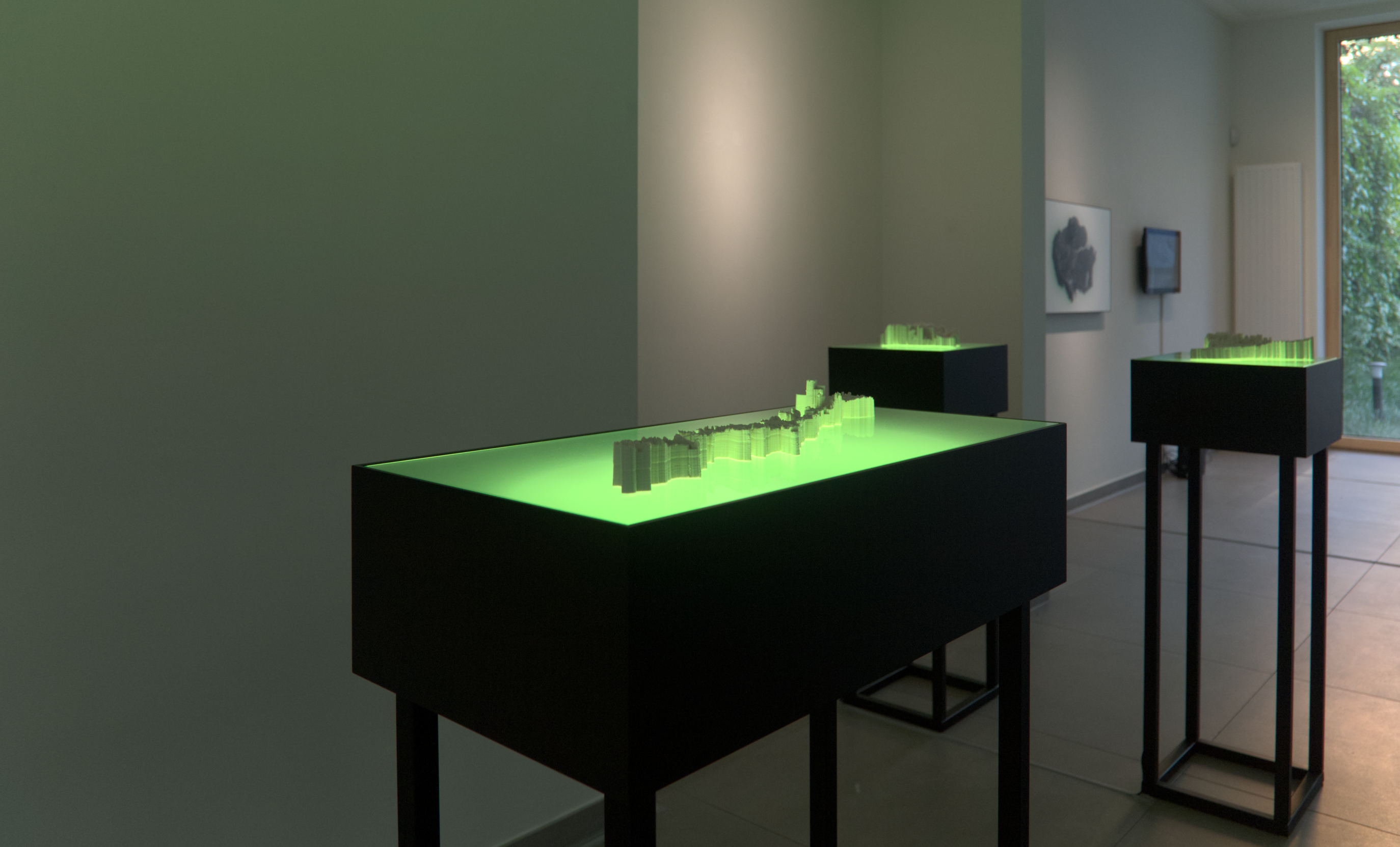
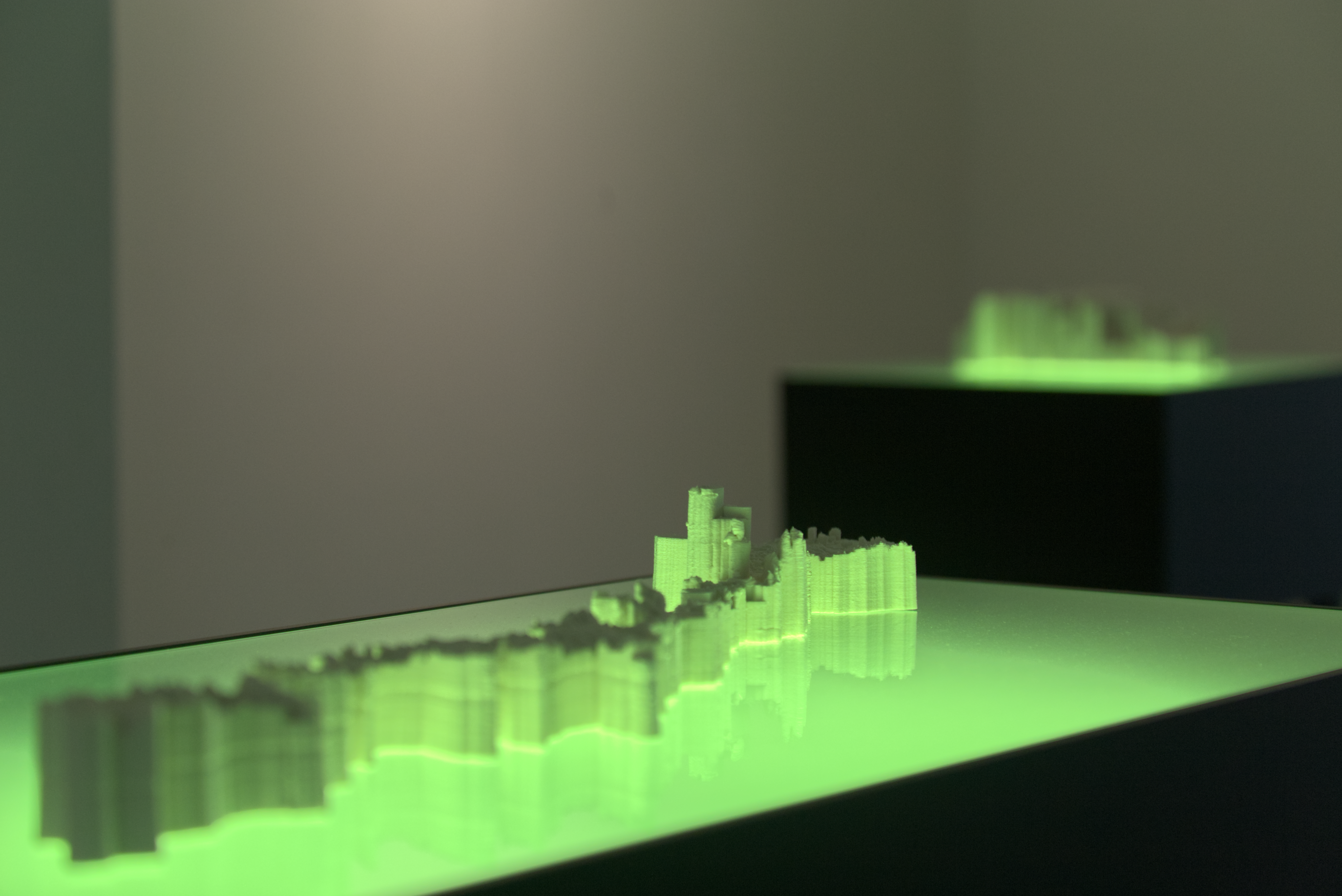
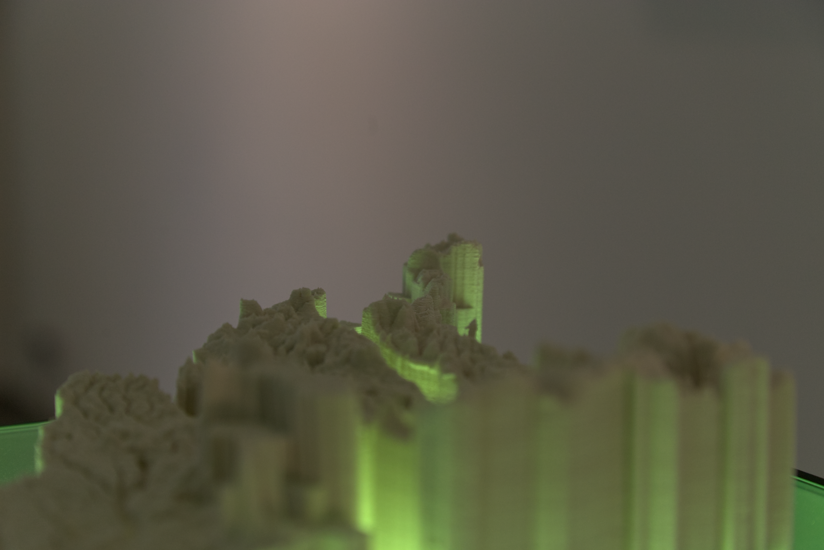
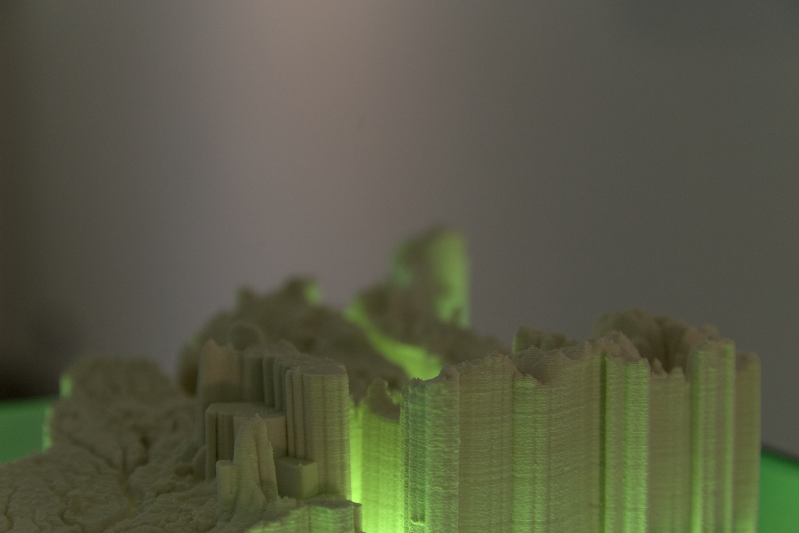
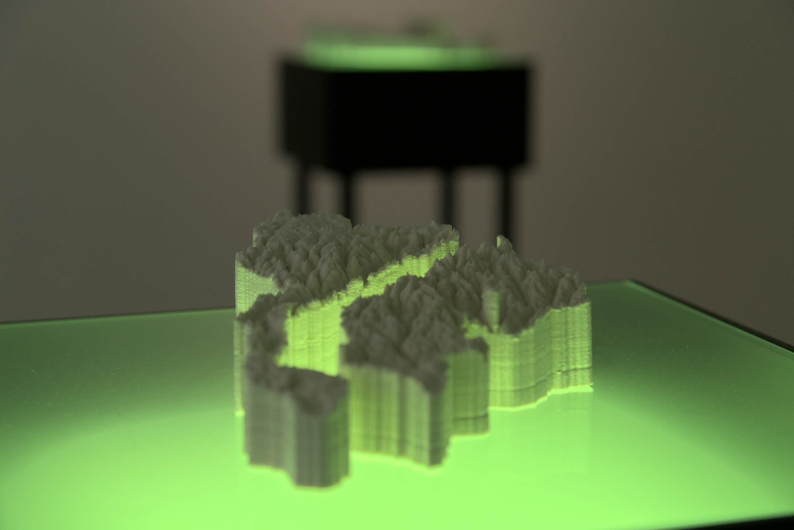
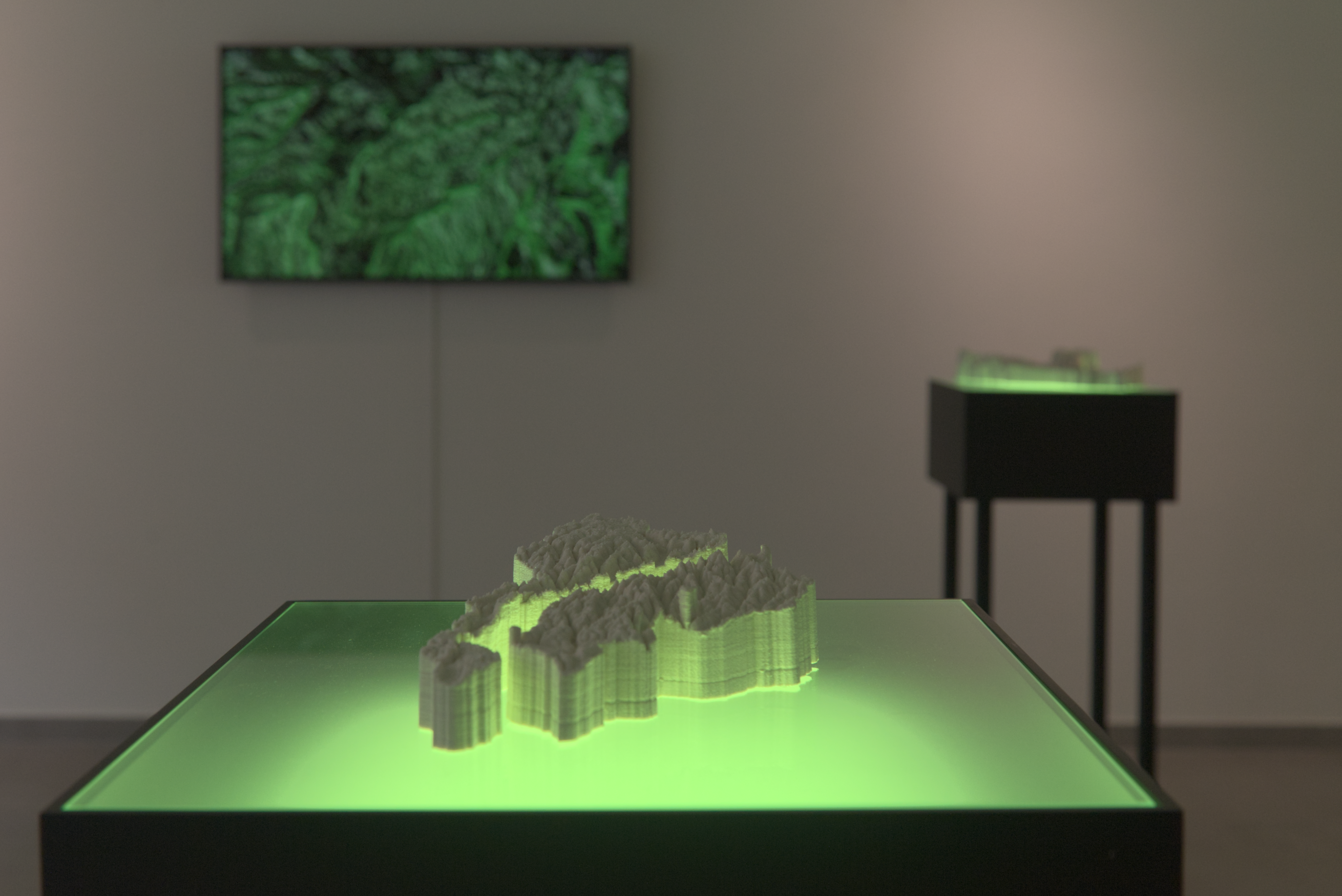
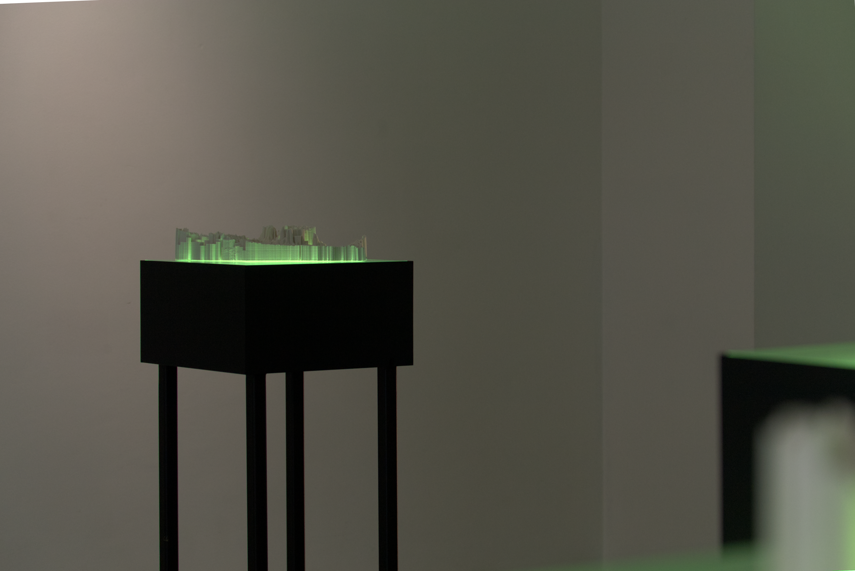
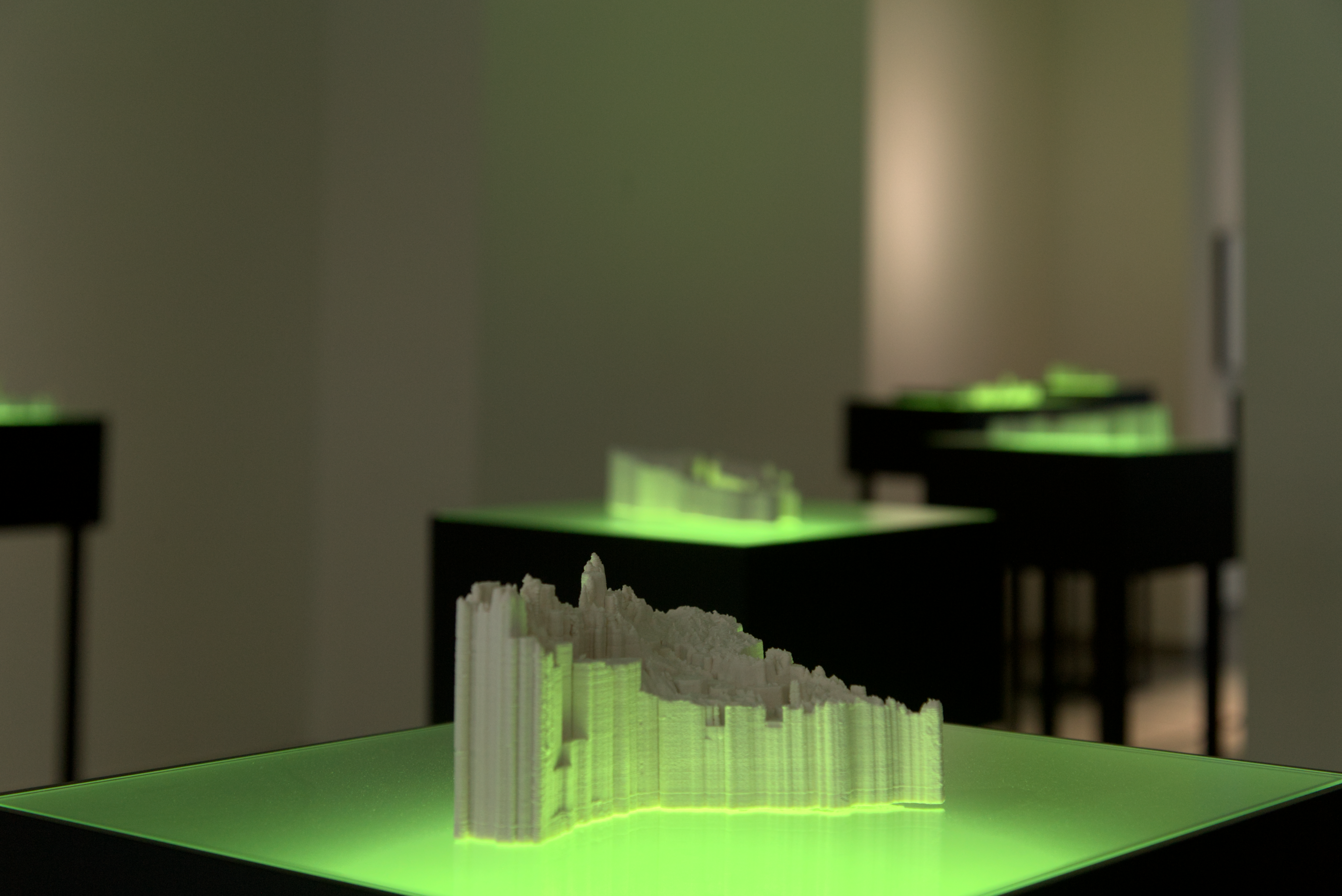
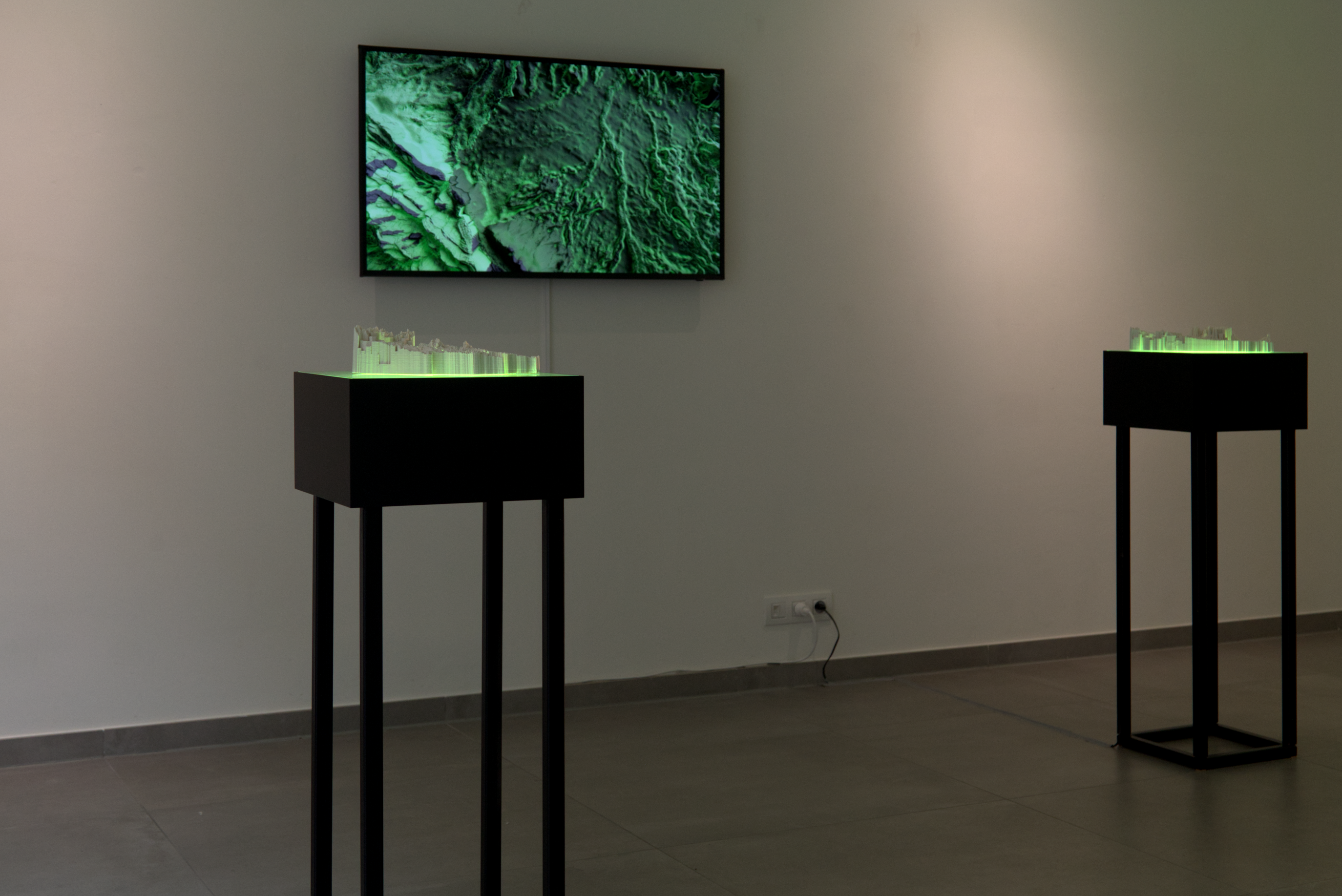
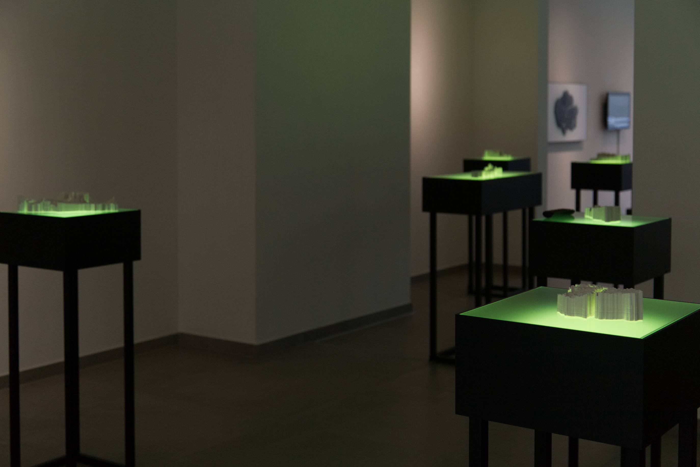
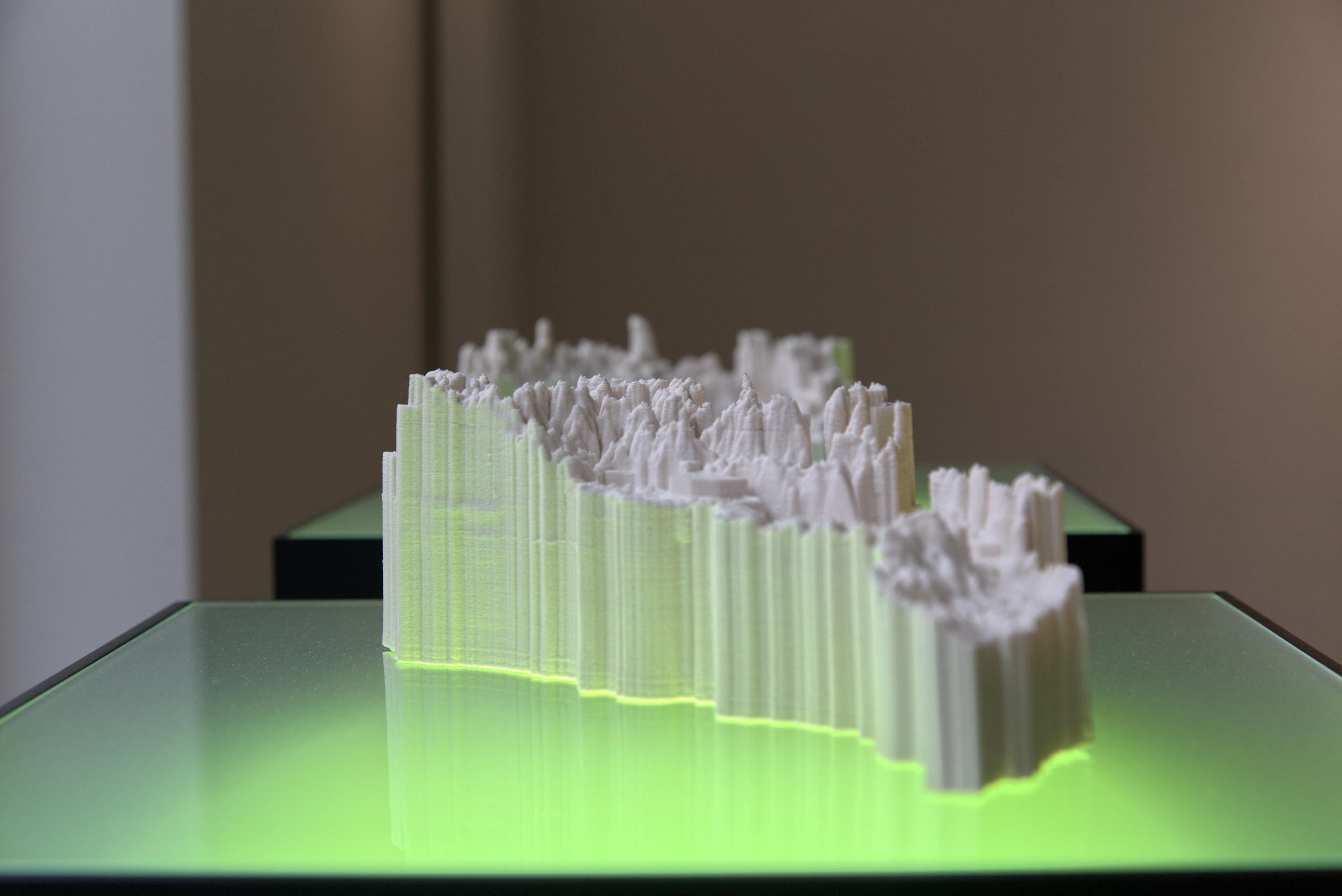
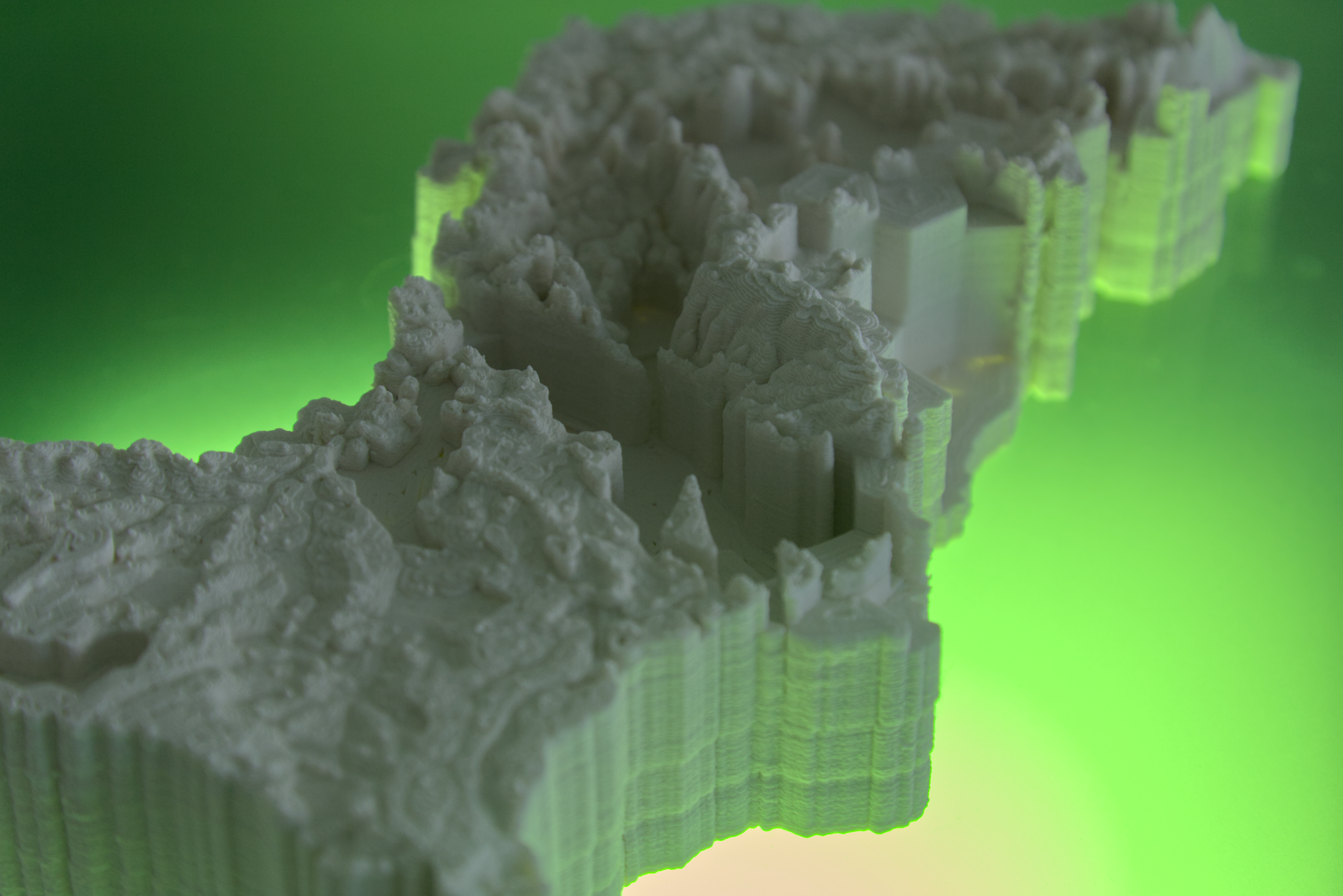
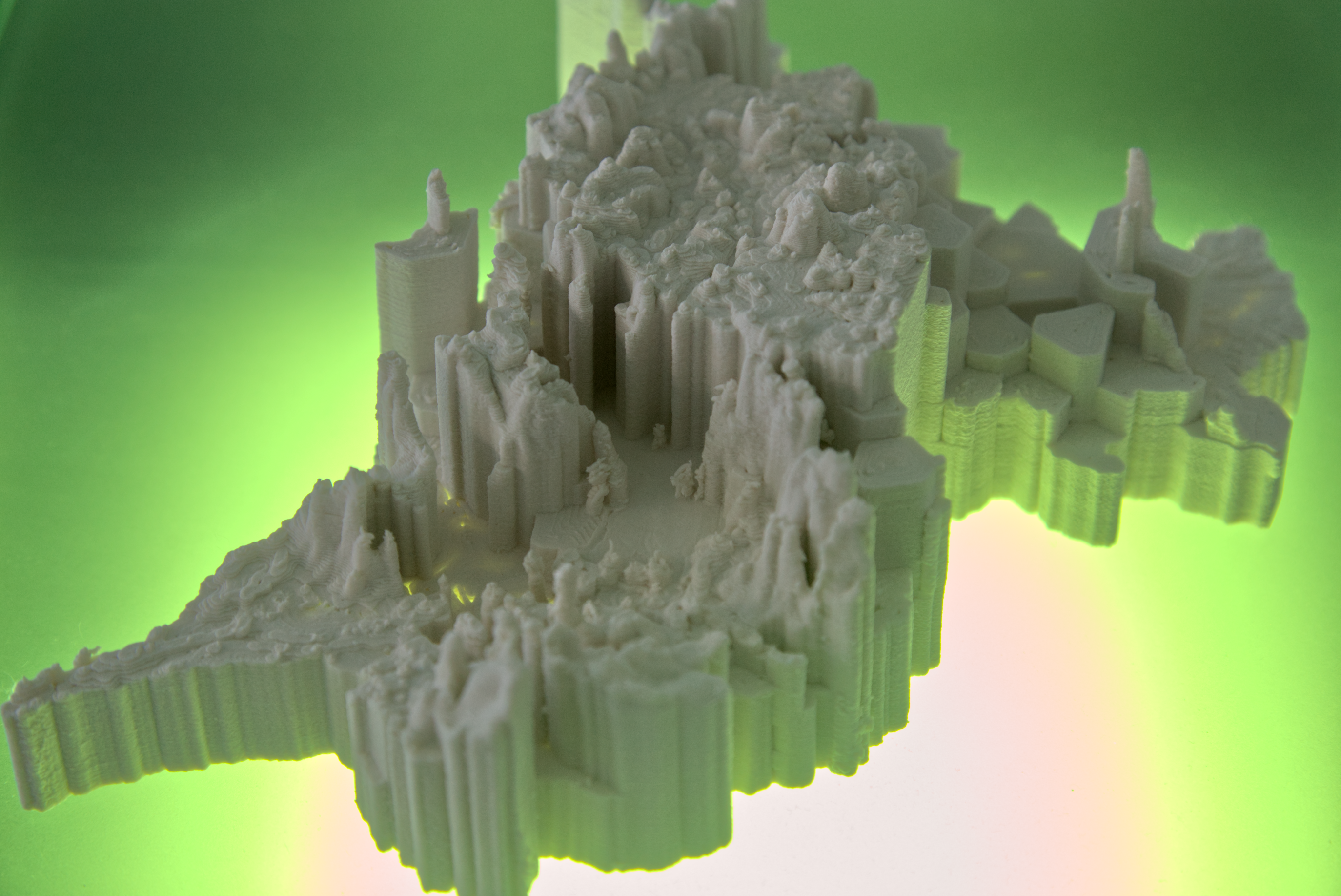
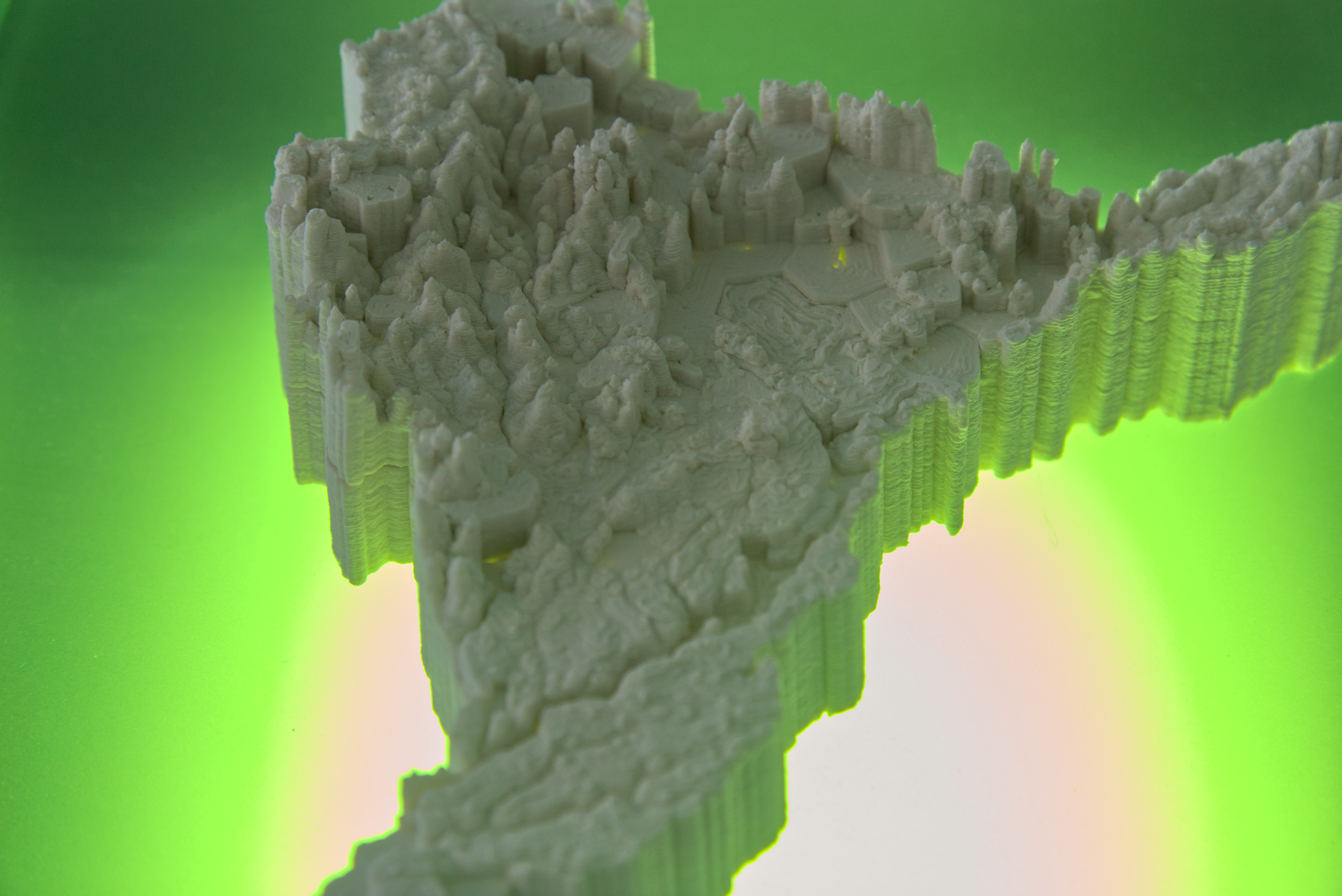
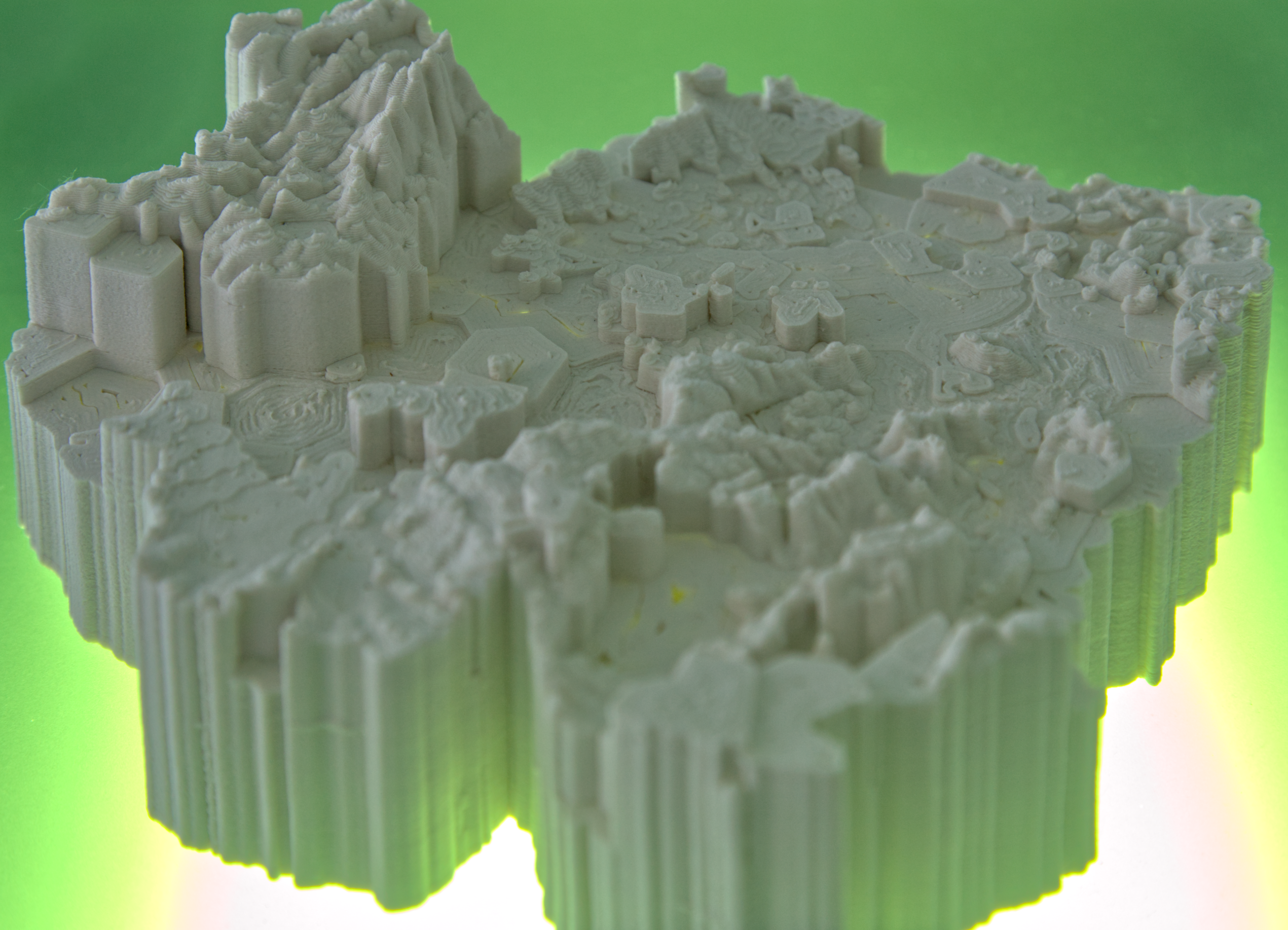
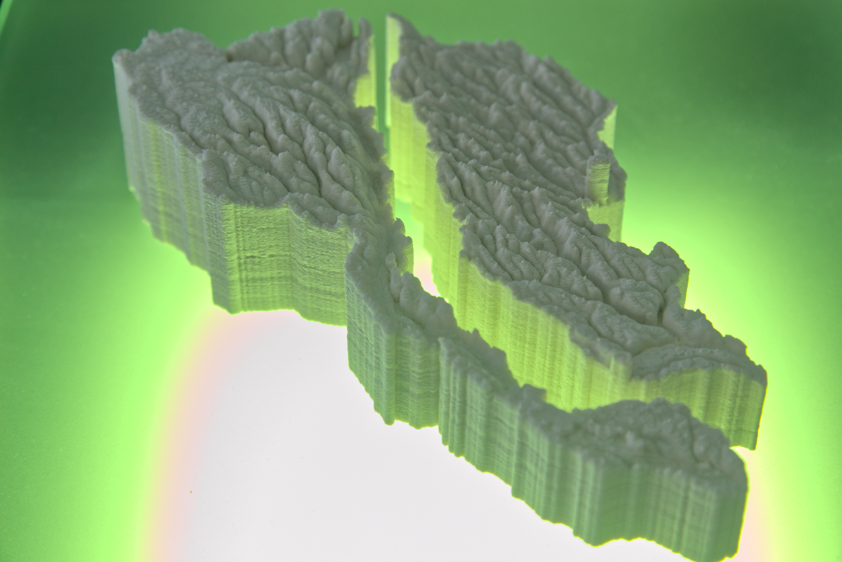
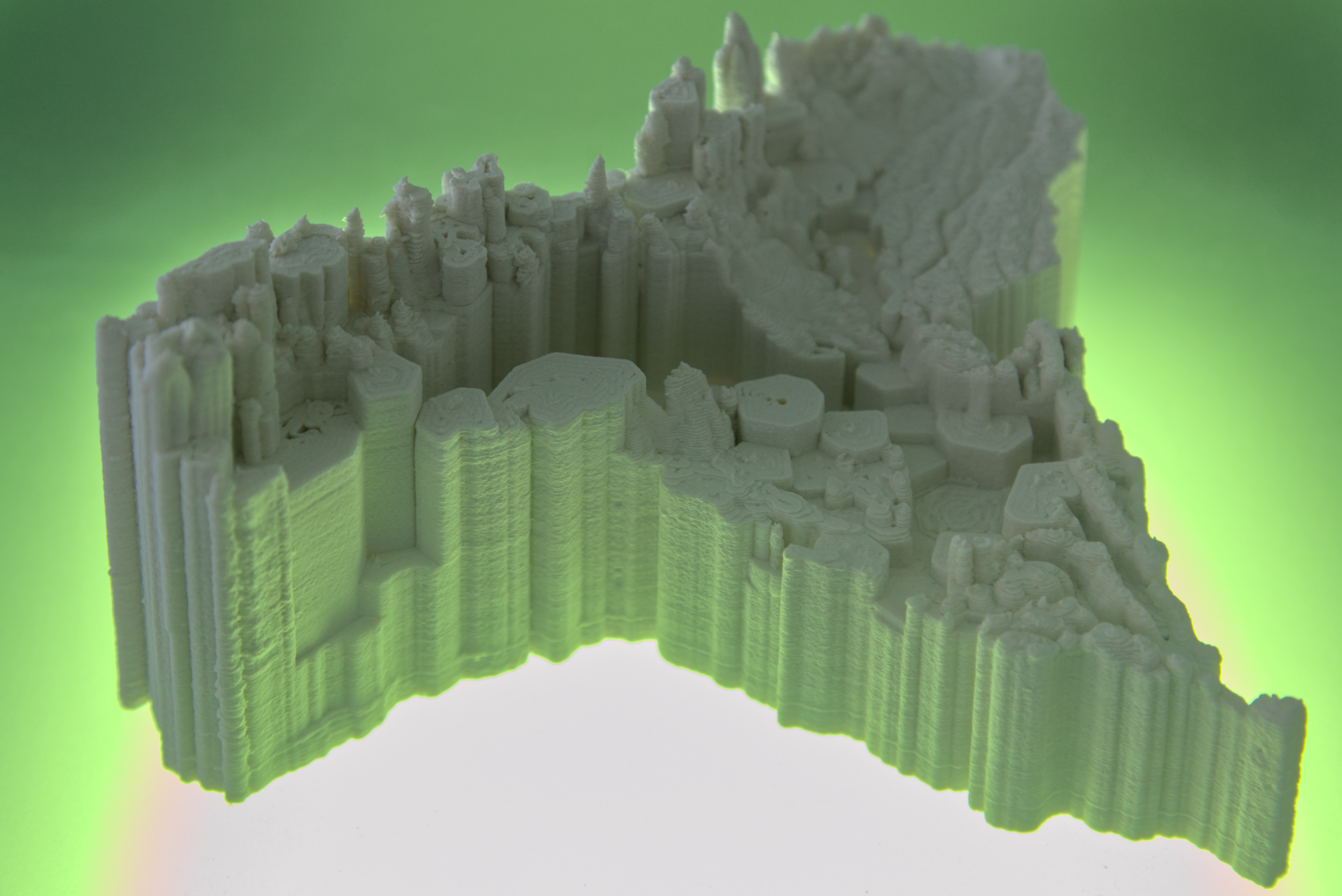
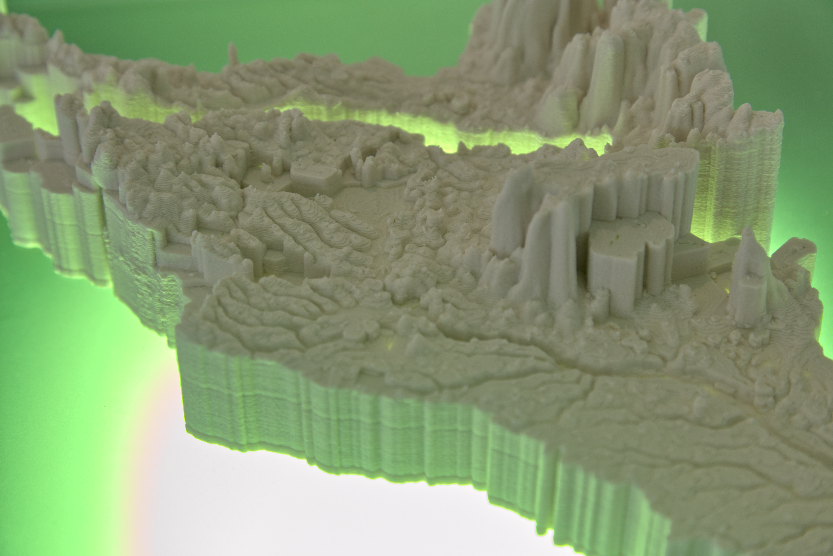
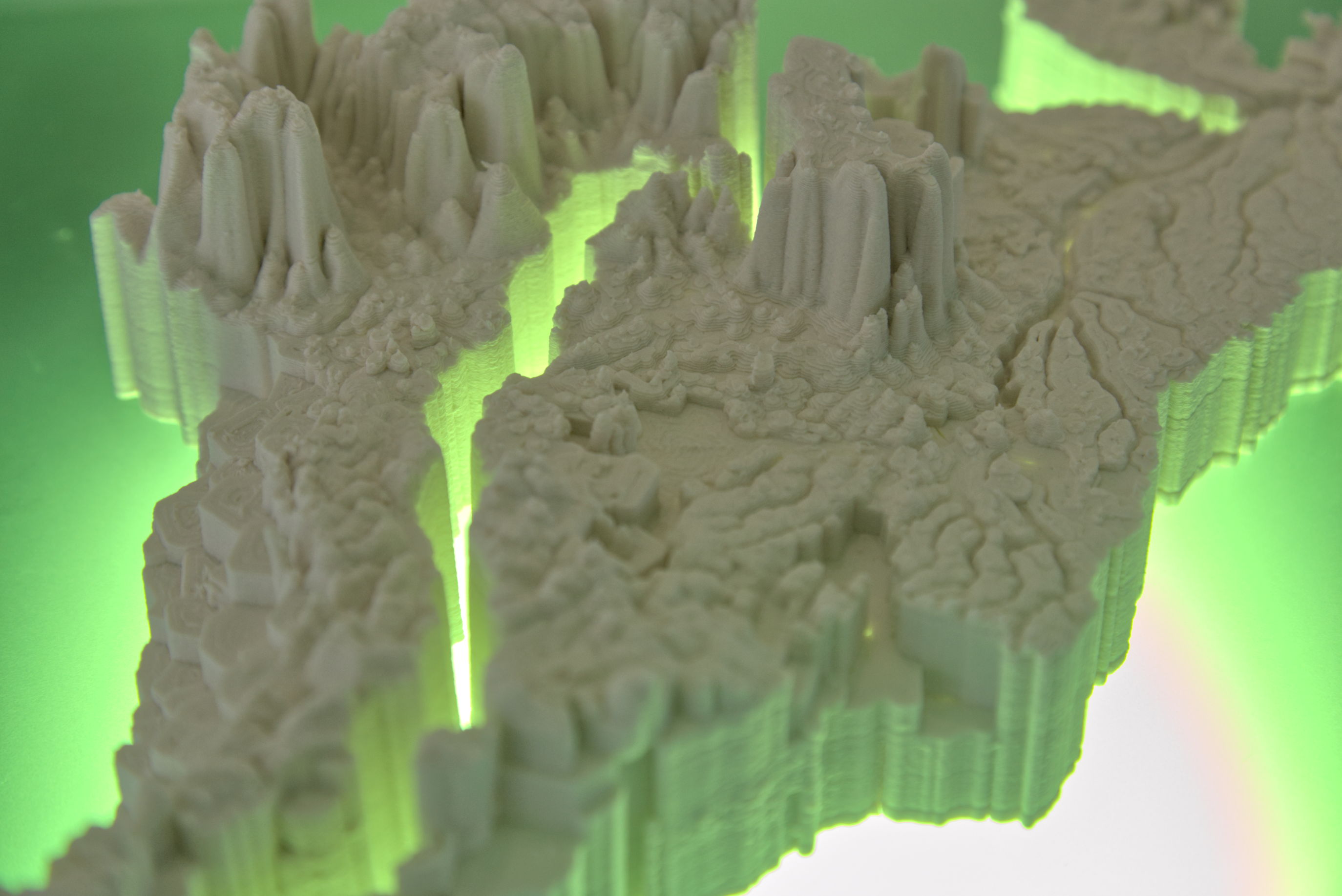
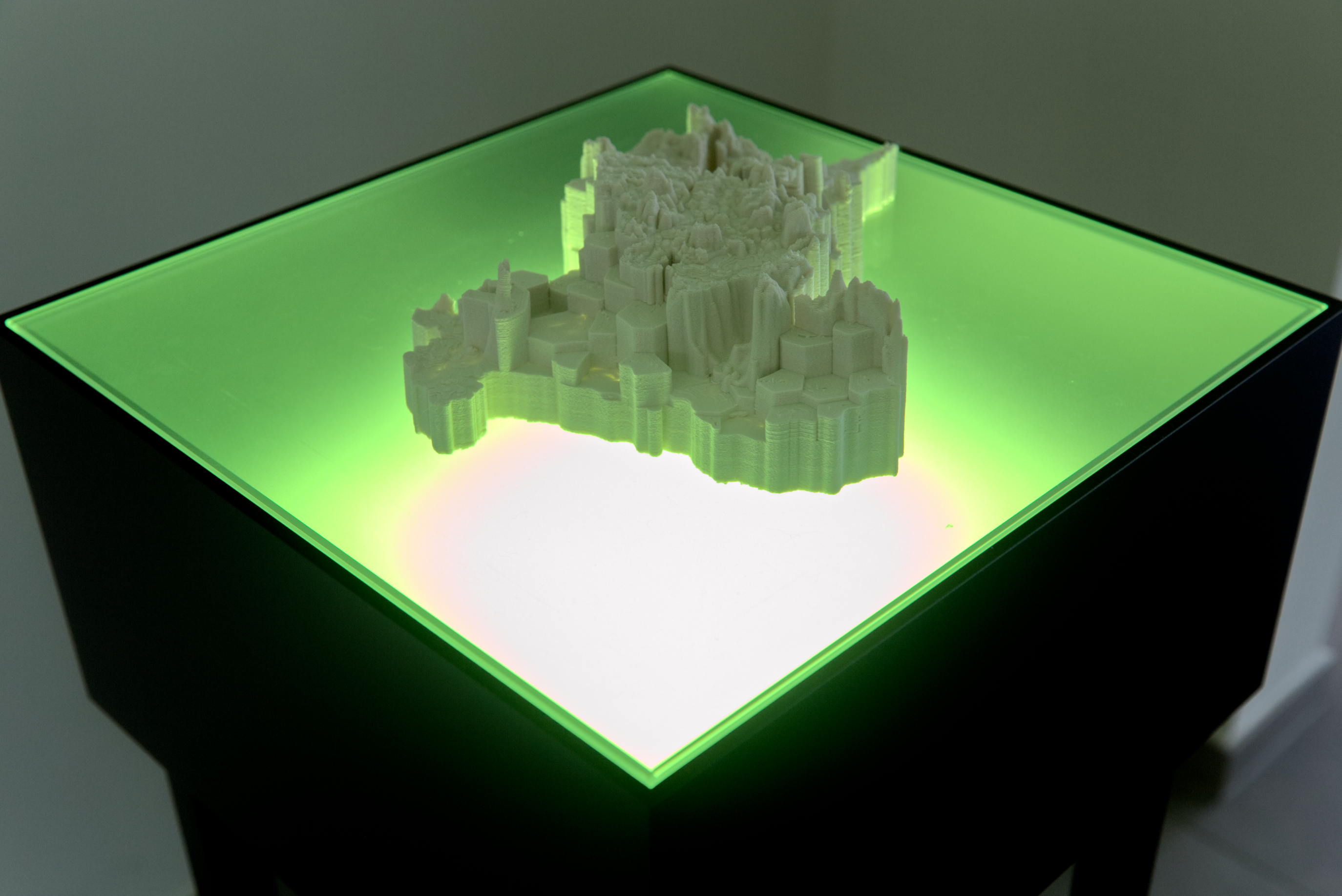
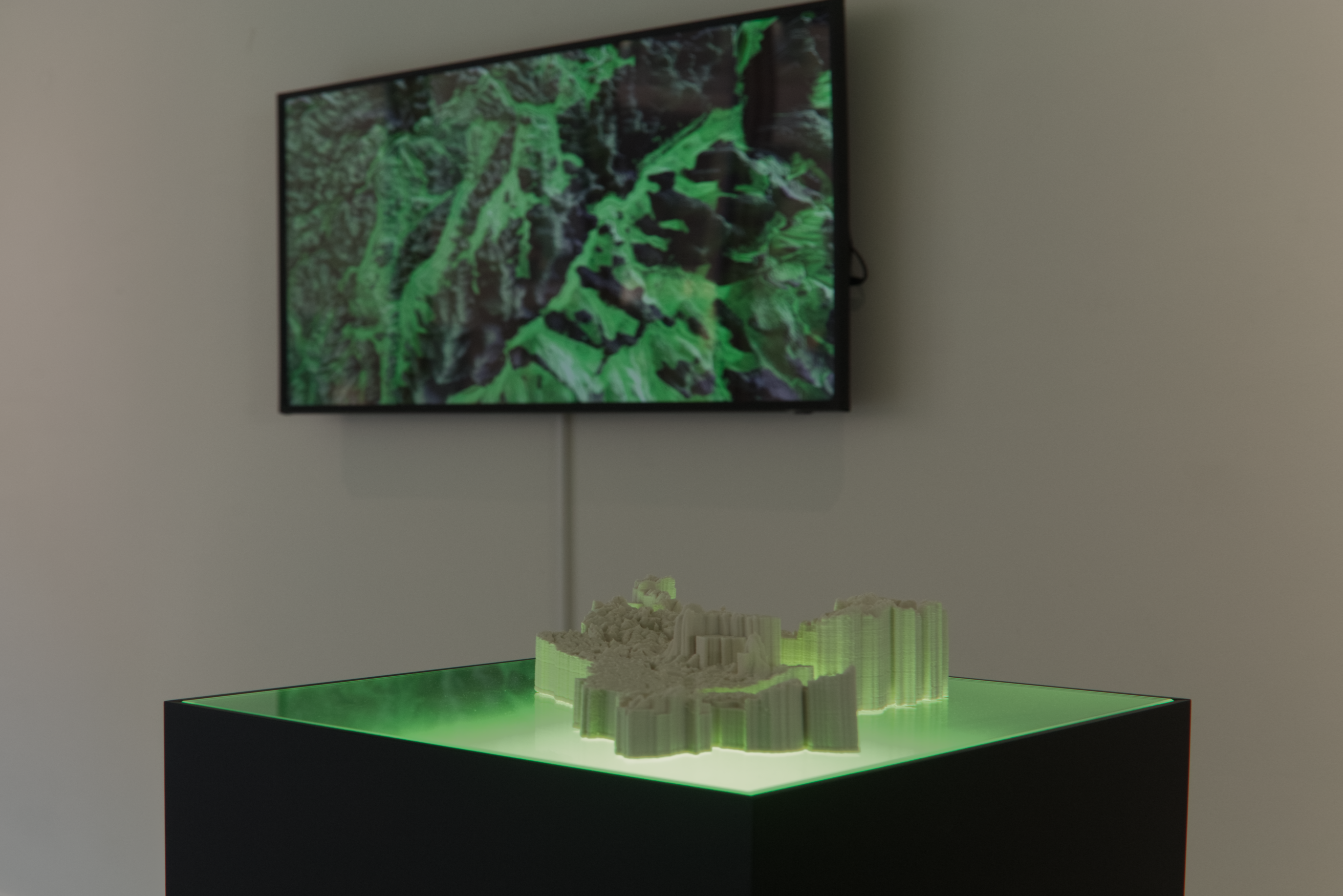
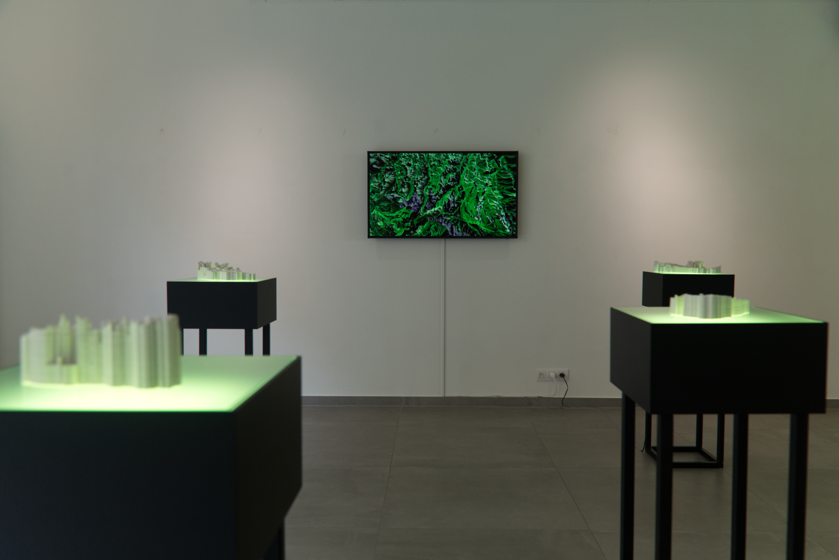
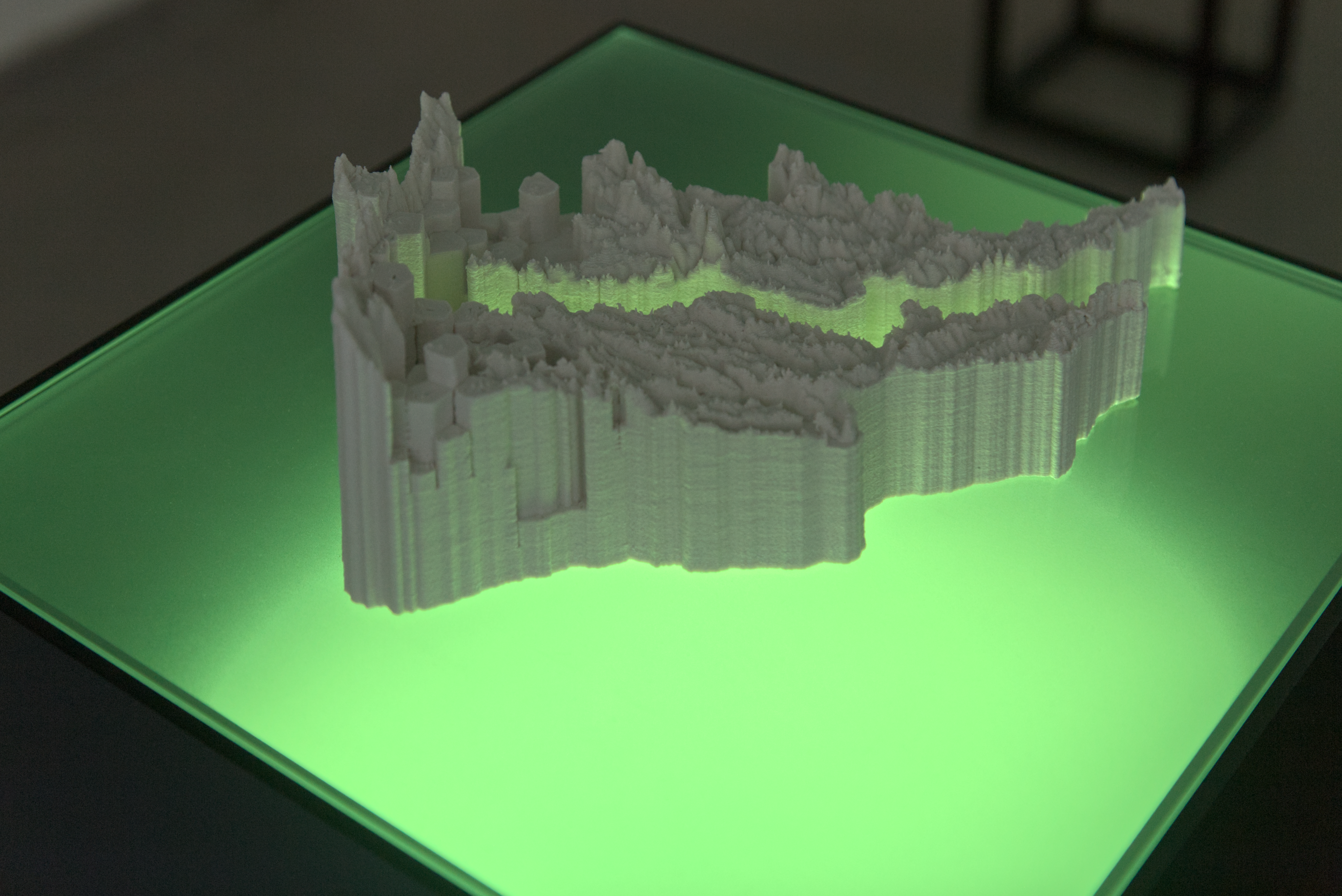
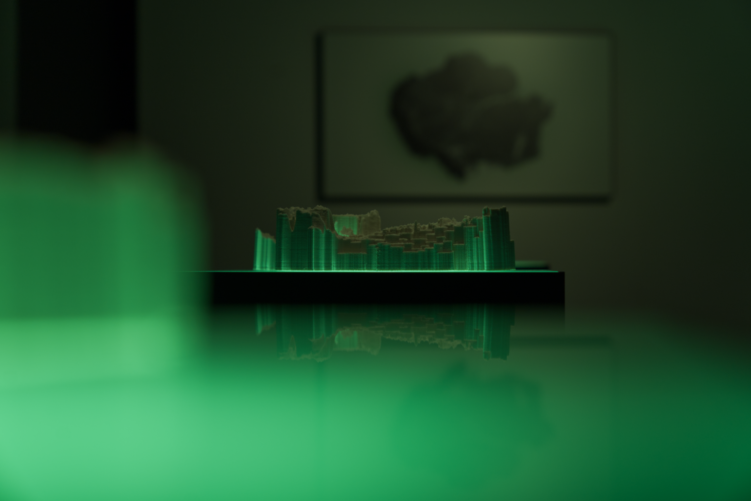
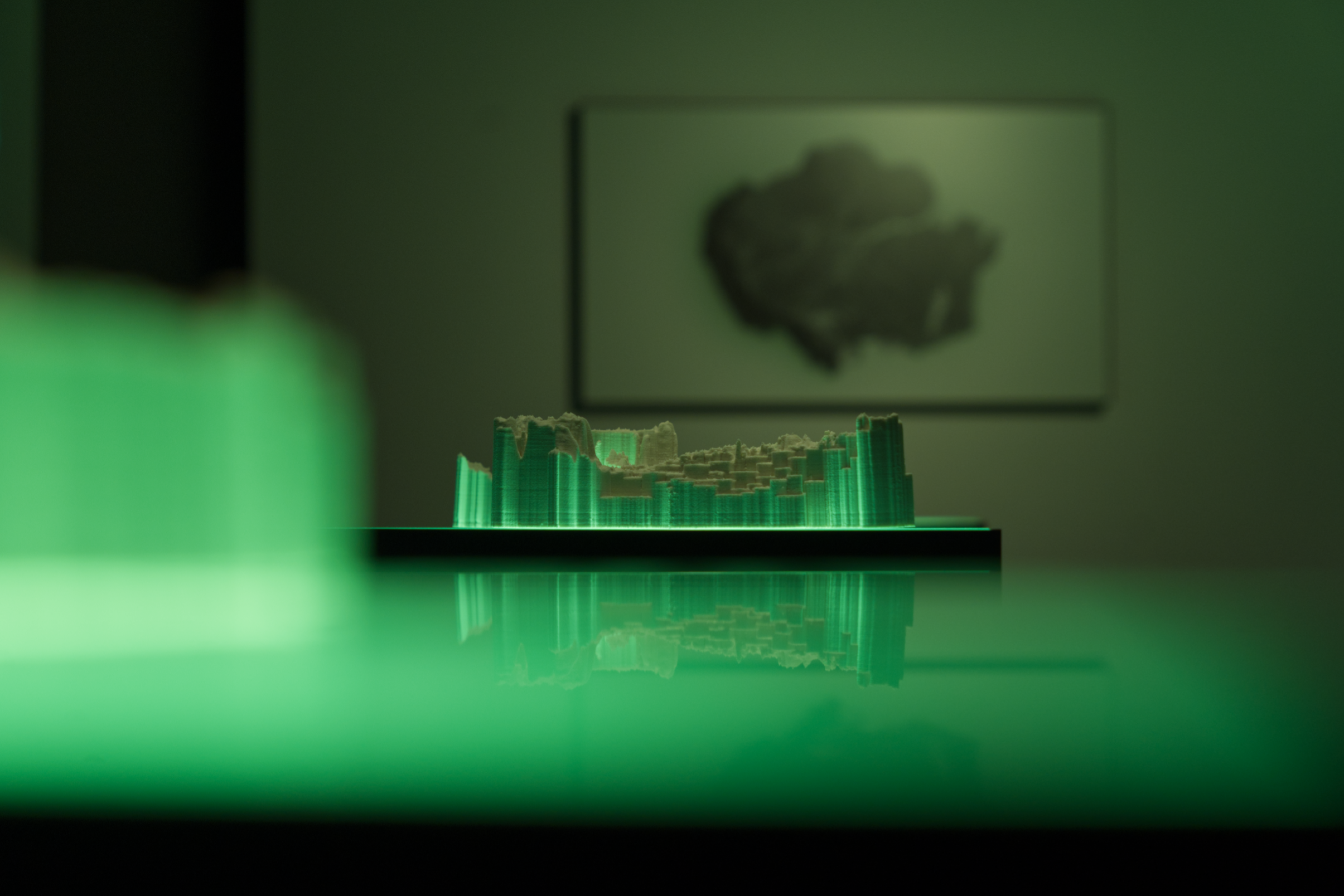
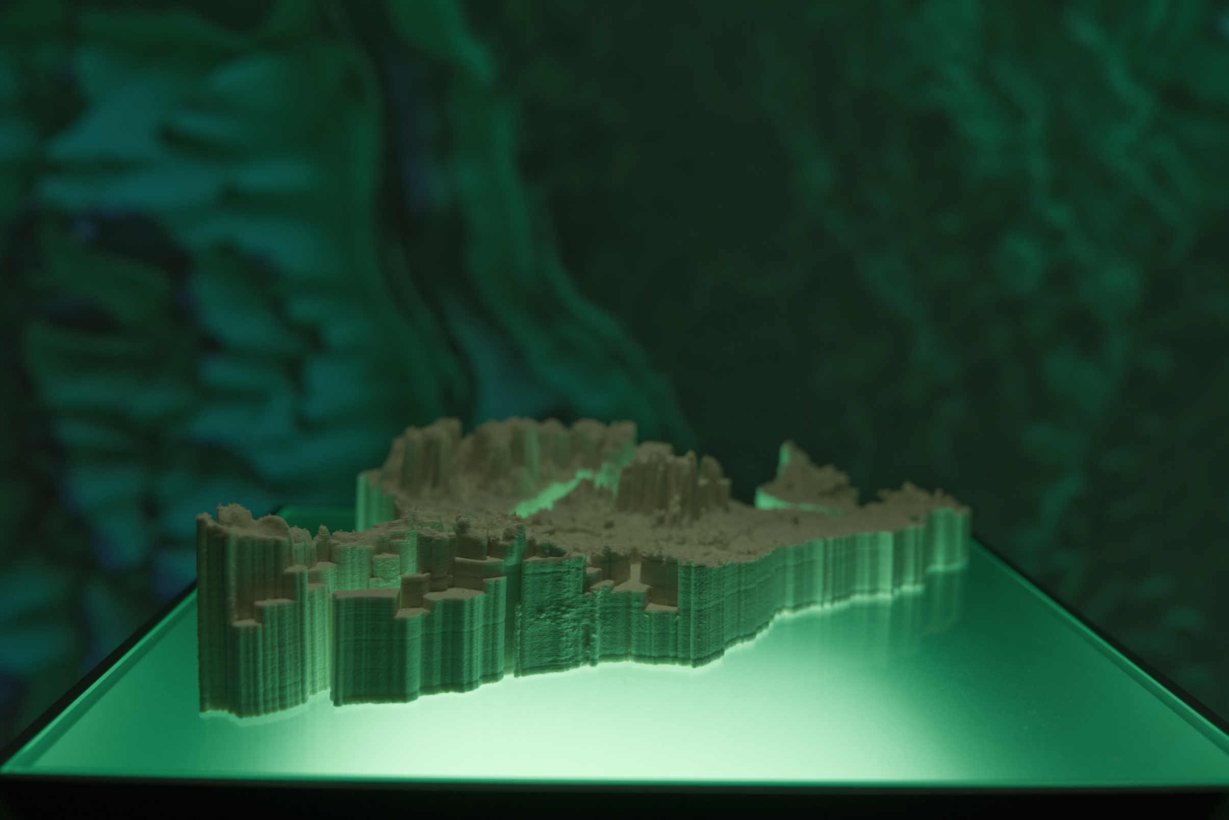
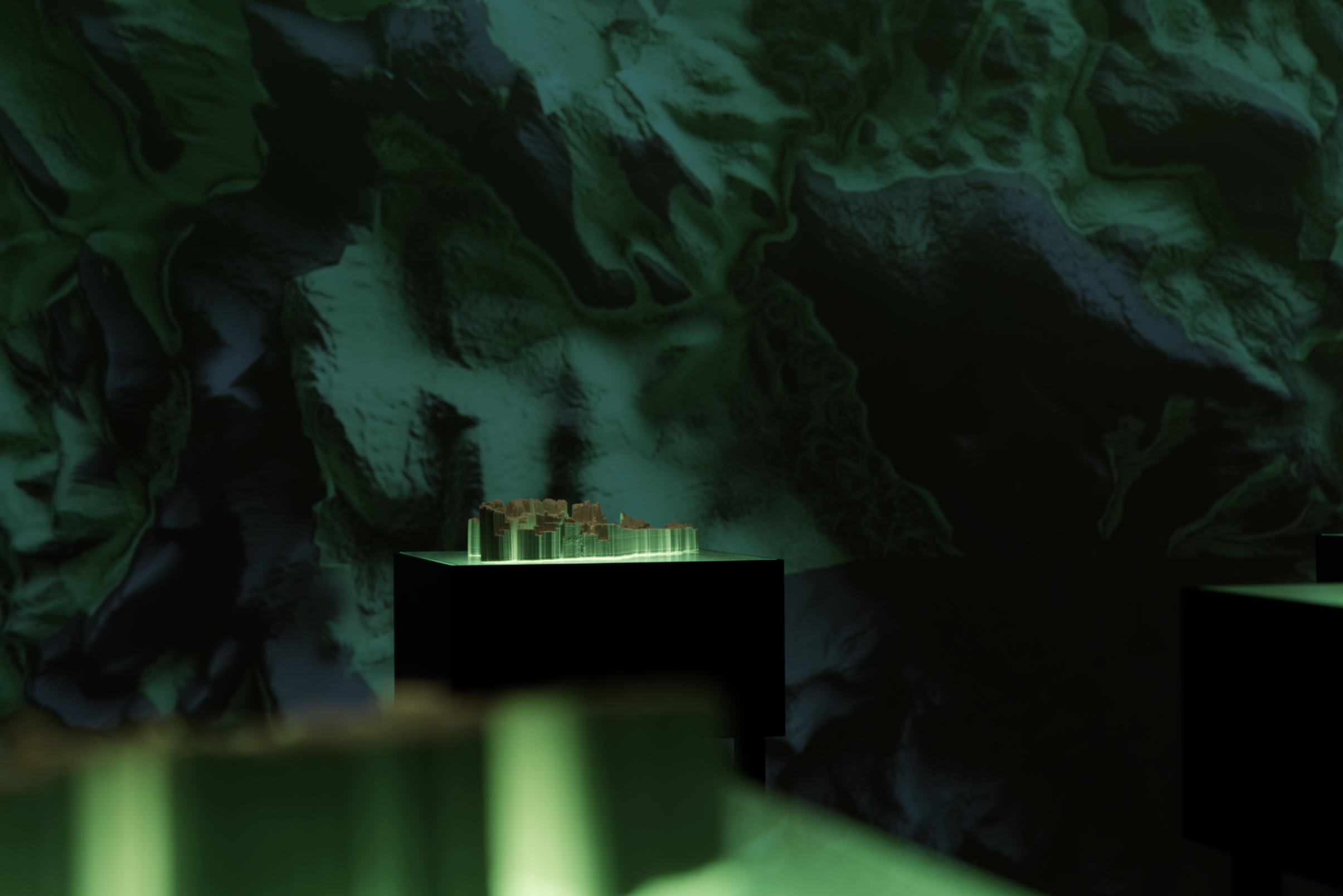
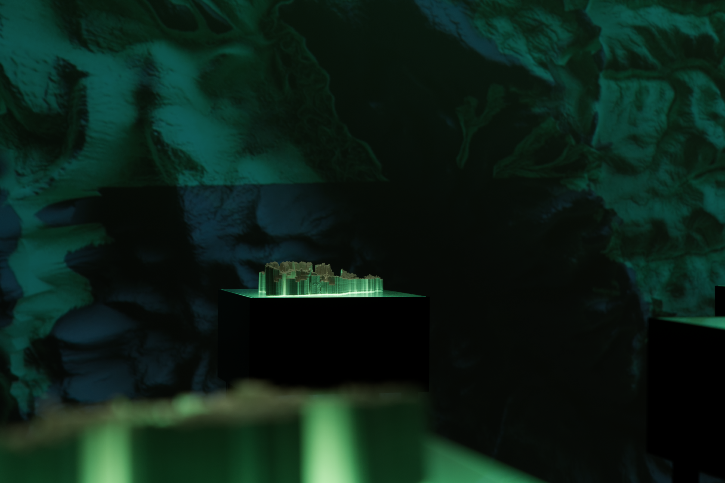
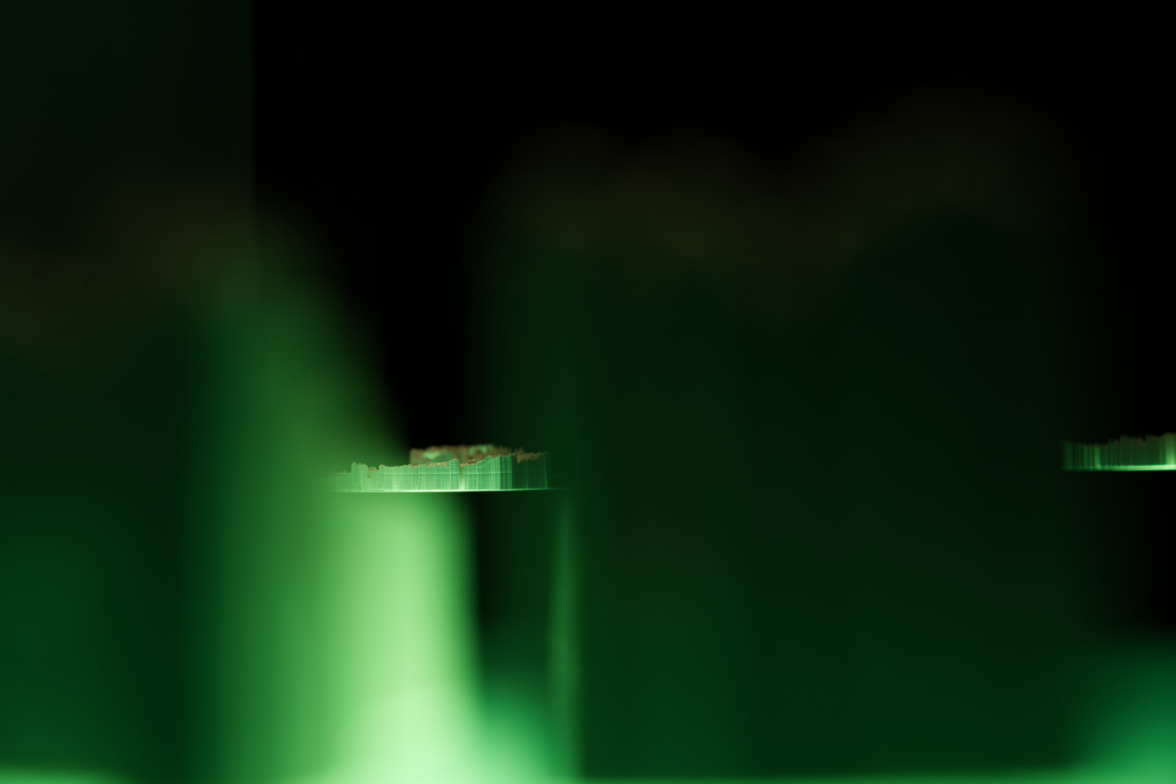
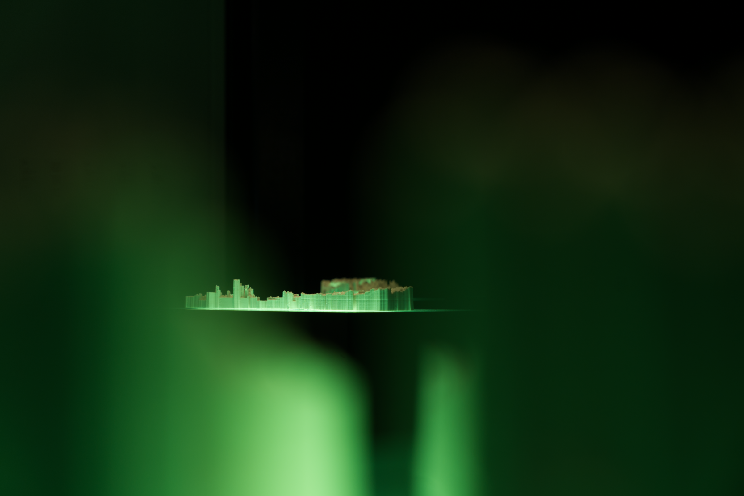
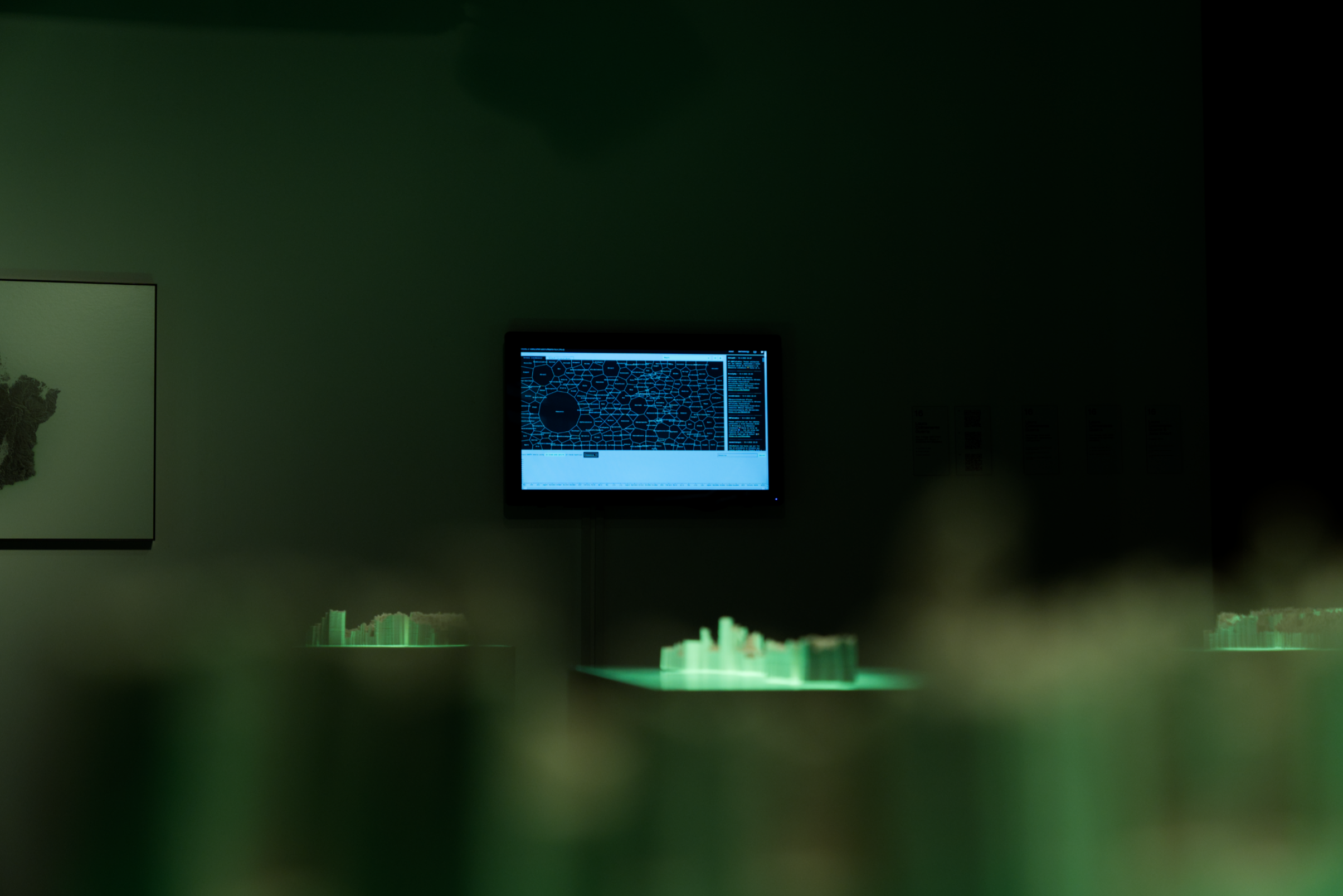
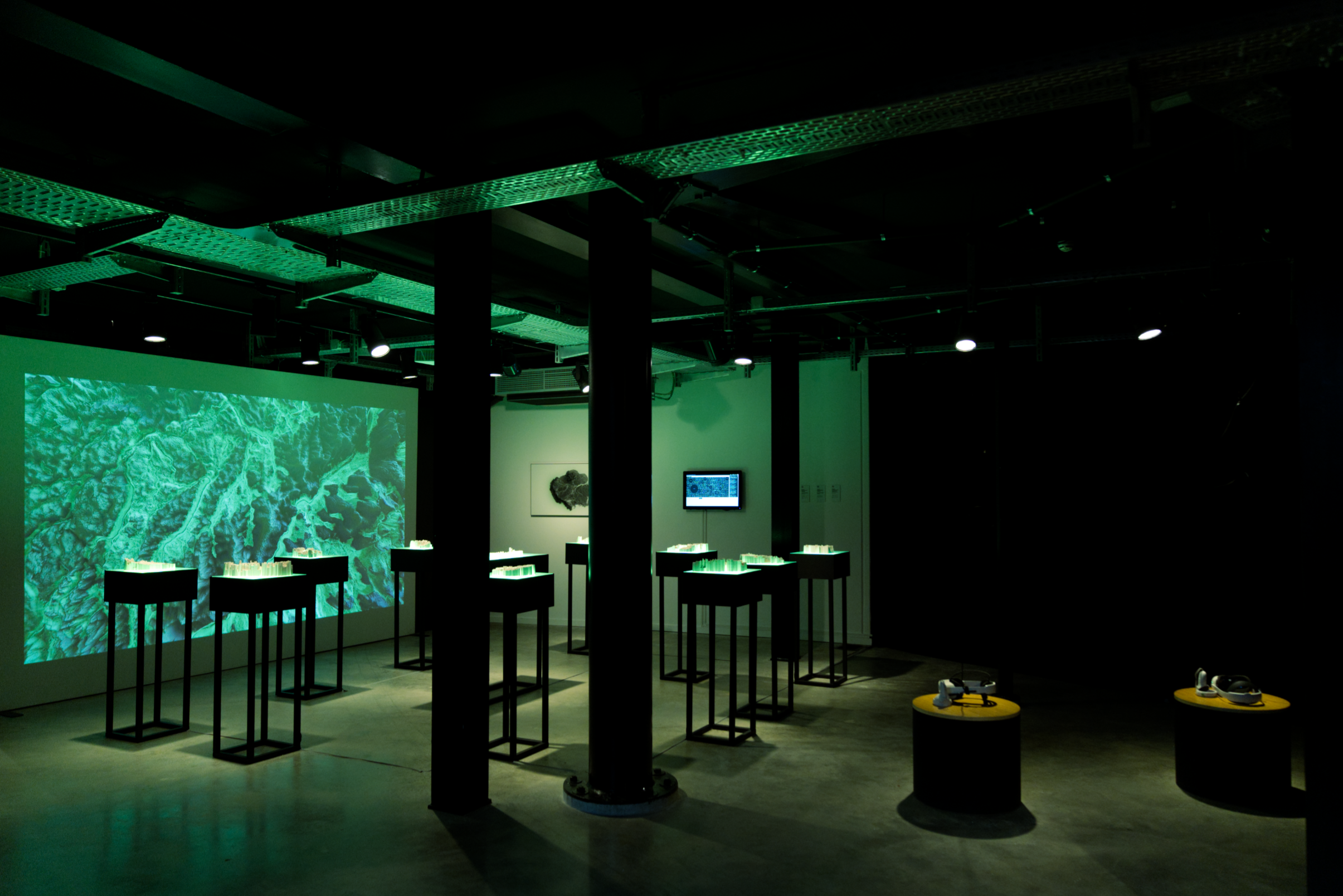
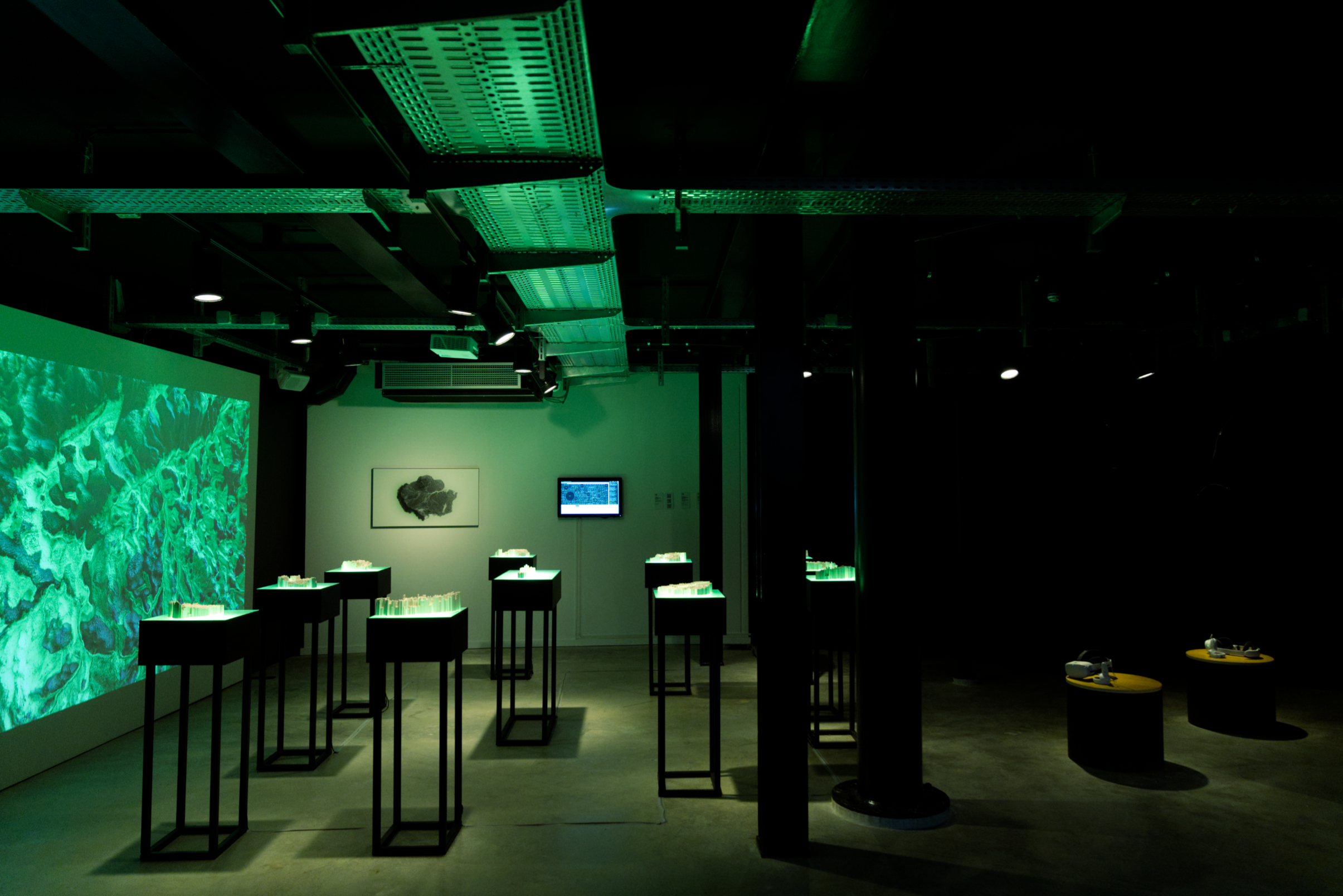
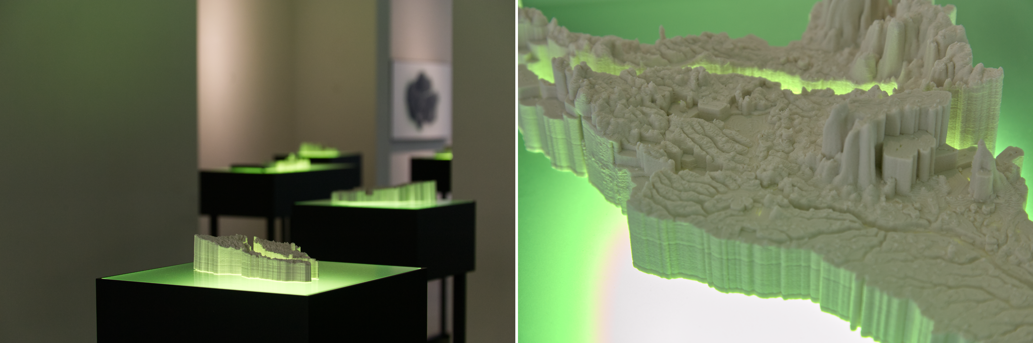
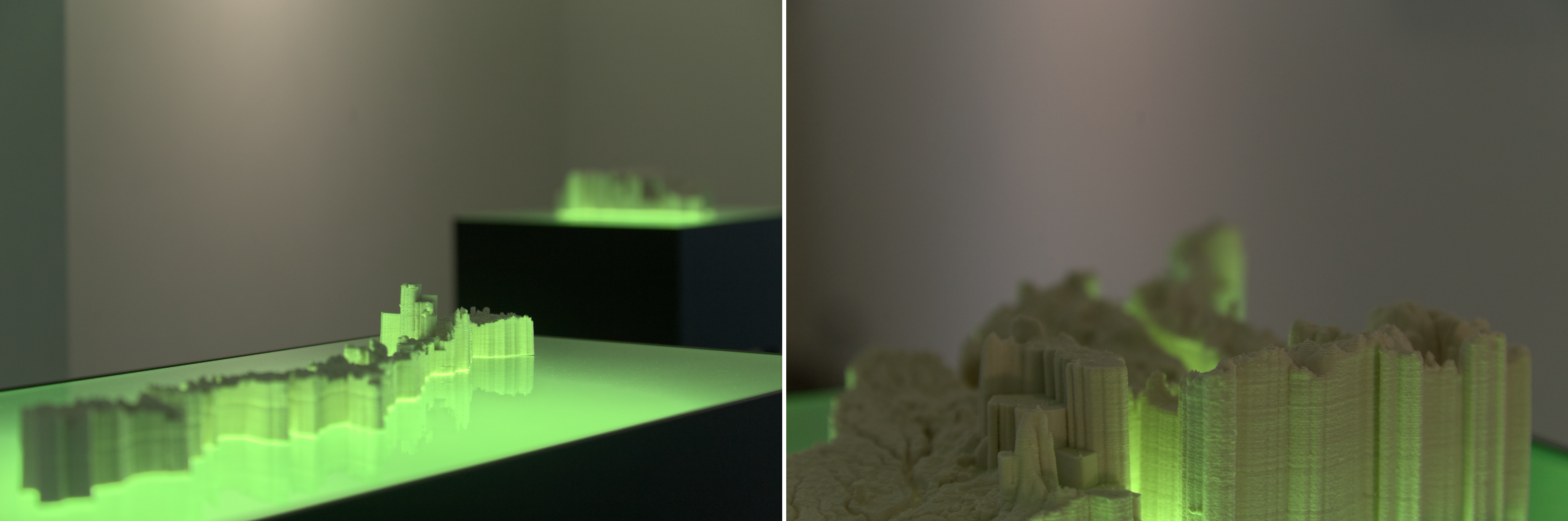
The second chapter of the Ríos Trilogy consists of a series of twenty-one sculptures developed through a process of digital hybridisation using Amazon-related data. Each sculpture is based on topographic data from a specific territory.
The twenty-one territories are outlined by the basins formed by the primary tributary rivers of the Amazon River:
Japurá-Caquetá /Iça-Putumayo + Napo / Marañon + Huallaga / Javari / Ucayali / Juruá / Purus / Madre de Díos + Beni / Mamoré + Guaporé / Madeira + Aripuanã / Juruena + Tapajós / Iriri + Xingu / Araguaia / Tocantins / Mearim / Trombetas / Branco + Guiana Highlands / Negro + Vaupés / Guaviare + Guainía / Suriname + French Guiana / Amazon floodplain
This hybrid, speculative, cartographic work acts as an archaeological artefact that catalogues the socio-environmental issues confronting the Amazon region while capturing the semantic relationships generated around these problems on social media.
The sculptures were 3D printed using clay (porcelain).
We establish social and environmental damage occurring in the Amazonia, by mapping the advancement of threats and pressures the Amazon region faces. For this purpose, we use use statistical data and geospatial socio-environmental information formulated by the RAISG - Amazon Geo-Referenced Socio-Environmental Information Network)
The main threats connecting the ecological and social damage infringed on Amazonia by human extractivist practices include:
The construction of water dams, the extraction of metals and minerals from the soil and the rivers, oil and gas extraction, deforestation of the rainforest to accommodate cattle (beef and leather) and support the production of soy, palm oil and timber.
The geospatial socio-environmental information data formulated by the RAISG is combined with the linguistic analysis performed by the ONLINE APPLICATION RIVERS // AMAZONIA GEO-LINGUISTICS ONLINE APPLICATION.
We performed experimental interventions on the topographic data of the Amazon Basin's territories, applying the linguistic data only to the places where socio-environmental damage has been registered. The process included a temporal procedure from December 2020 to December 2021. During this period, we created "Time Stamps", which we used to modify the topography of the Amazon River Basins.
We combined these data using georeferenced marks.
Each sculpture is based on digital elevation models that result from the process of combining:
A) TOPOGRAPHIC DATA.
B) LINGUISTIC ANALYSIS BASED ON RIVERS // AMAZONIA GEO-LINGUISTICS.
C) GEOREFERENCED INFORMATION RELATED TO SOCIO-ENVIRONMENTAL THREATS.
These interventions result in the twenty-one sculptures proposed in Chapter #2 of the Ríos Trilogy.
Credits
- Conception, direction, production, Laura Colmenares Guerra
- GIS analyst, Gabriel Codreanu
- 3D sculpting, Geert Melis
- 3D work & 3D printing, Laura Colmenares Guerra
- Porcelain advisor, Eve Vaucheret