RÍOS TRILOGY
RÍOS TRILOGY - 2023
SOCIO-ENVIRONMENTAL PERSPECTIVES ON THE AMAZON BASIN
The Ríos Trilogy is a three-chapter installation exploring the Amazon Basin from local and international perspectives. Through this hydrology-based body of work, the trilogy explores the relationship between language and the construction and definitions of territory.
This project examines the pressing socio-environmental challenges faced by the Amazon. Working with language, through the analysis of social networks, and in parallel analysing GIS data to analyse the threats derived from deforestation and the exploitation of natural resources, this body of work seeks to identify the meanings we attribute to the territory of the Macro-Amazon, a territory politically shaped by nine Latin American countries.
The Ríos Trilogy is composed of three chapters:
CHAPTER N.1 - RIVERS // AMAZONIA GEO-LINGUISTICS ONLINE APPLICATION
CHAPTER N.2 - HYBRID CARTOGRAPHIES
CHAPTER N.3 - R€¥€R$€ - VR
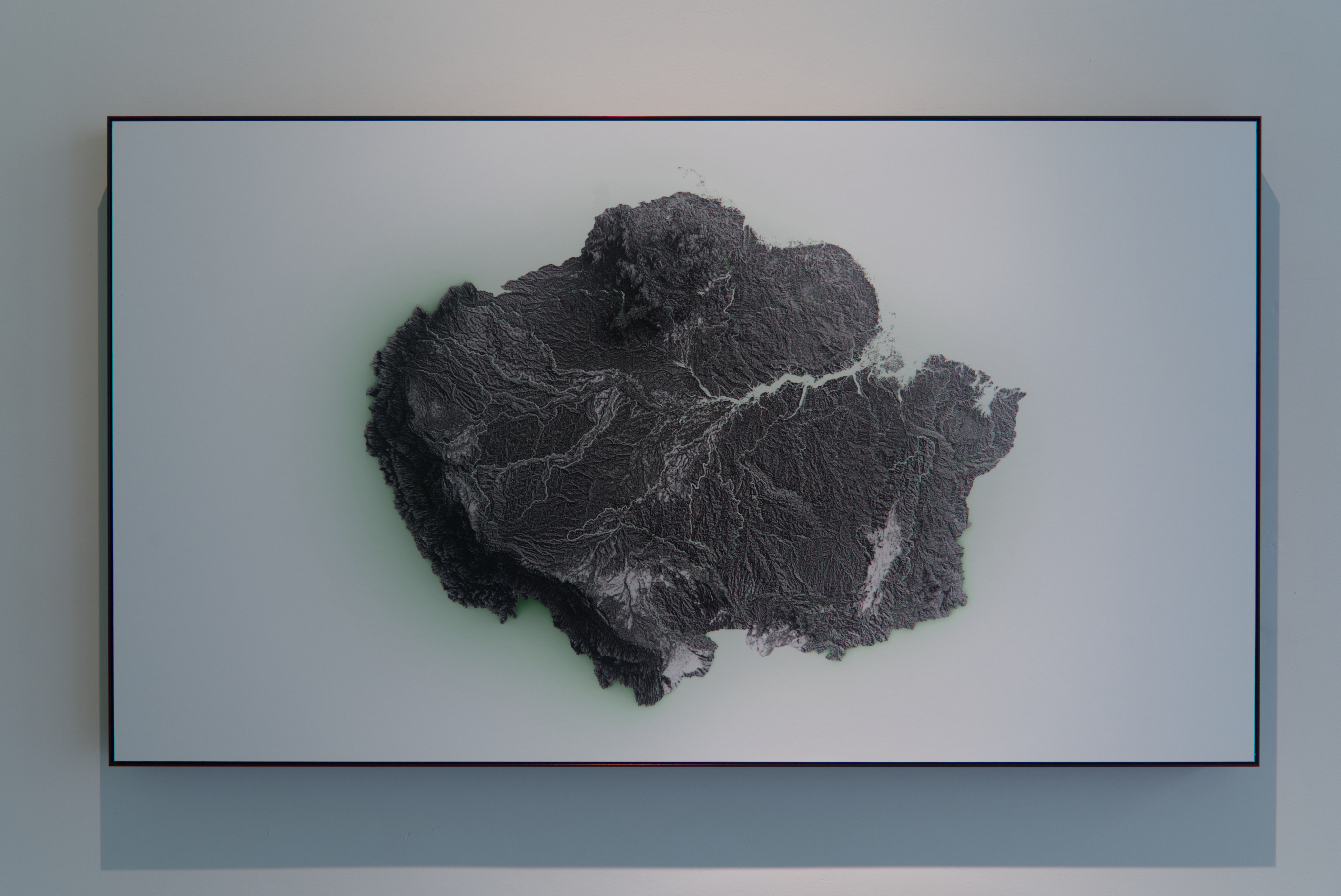
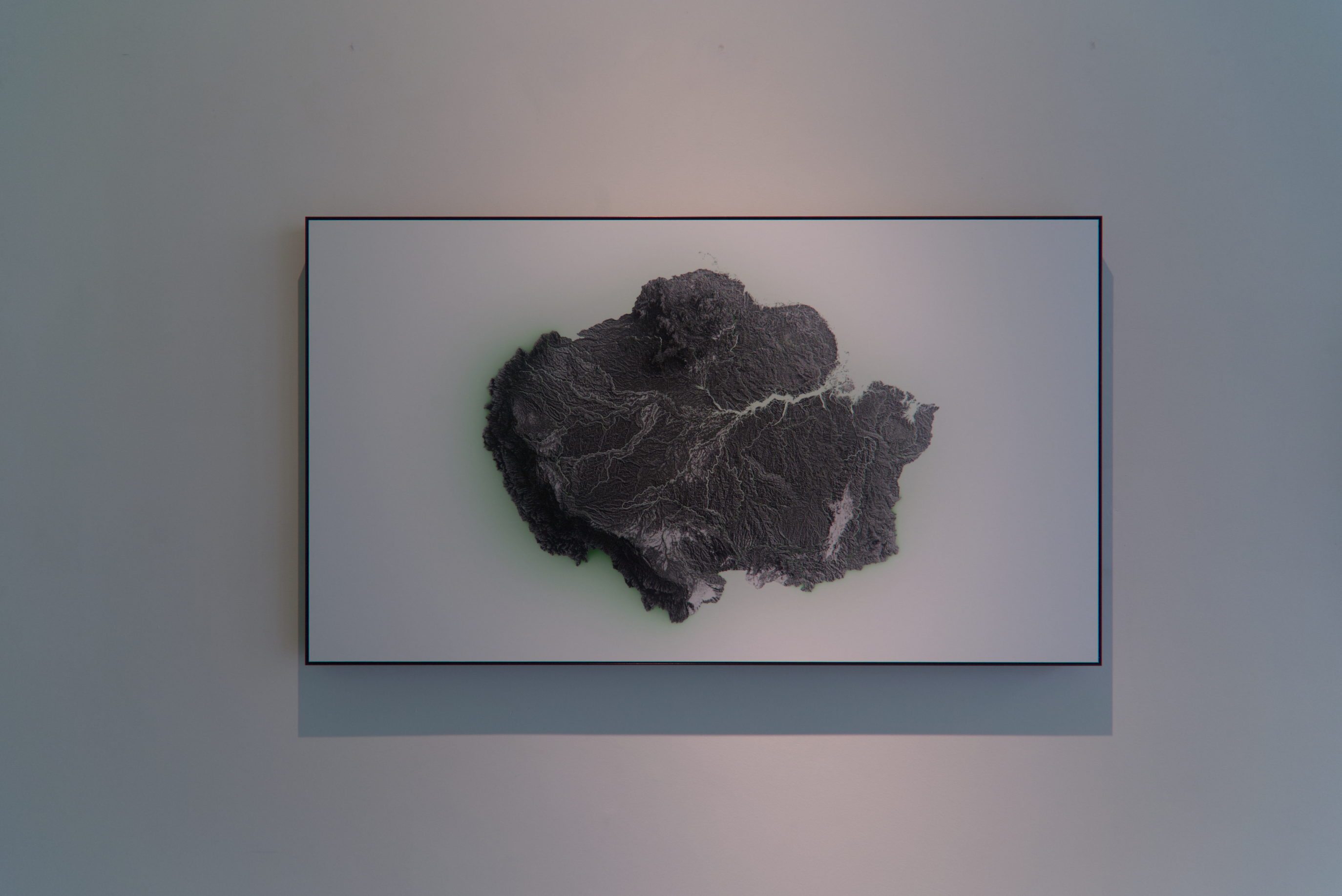
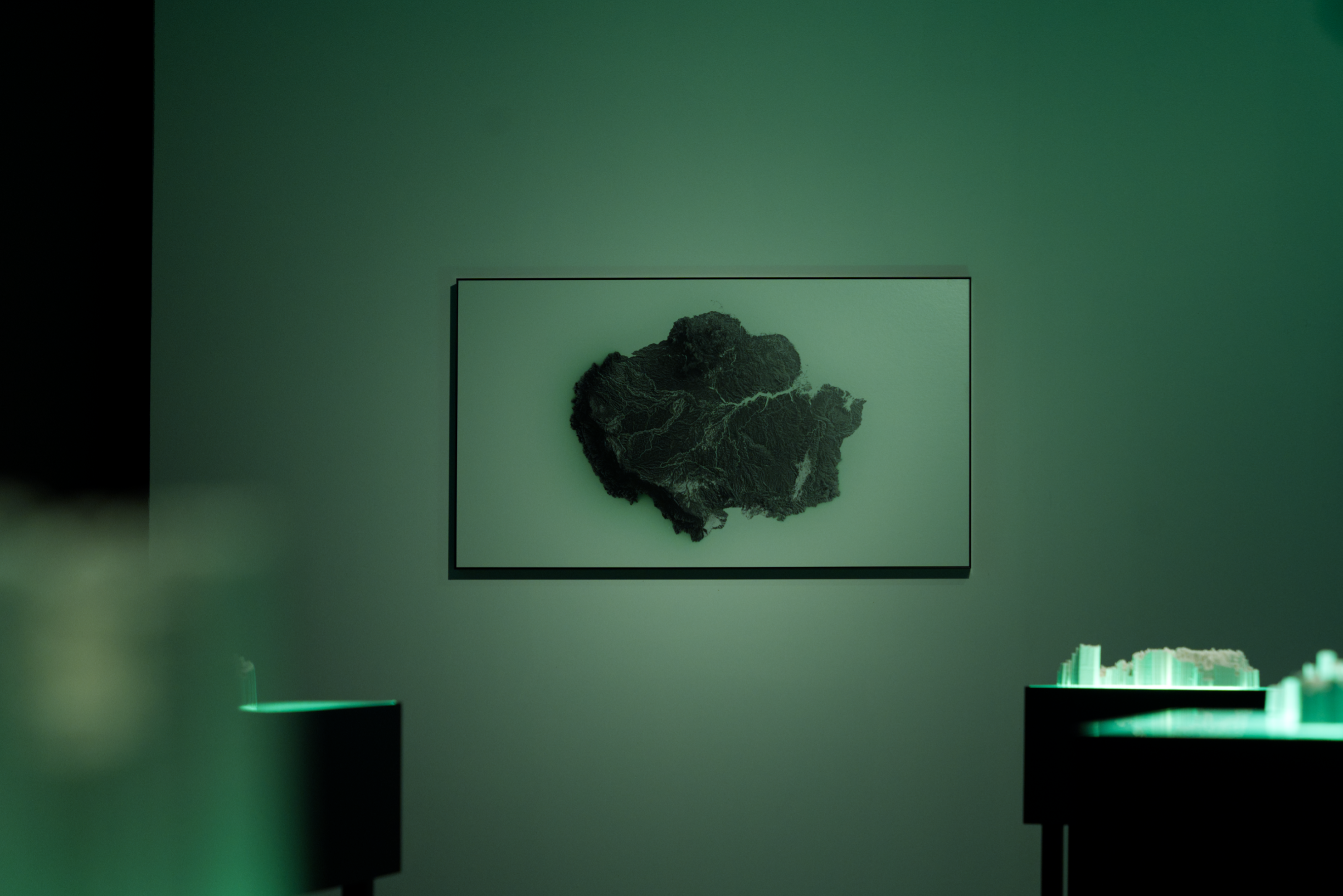
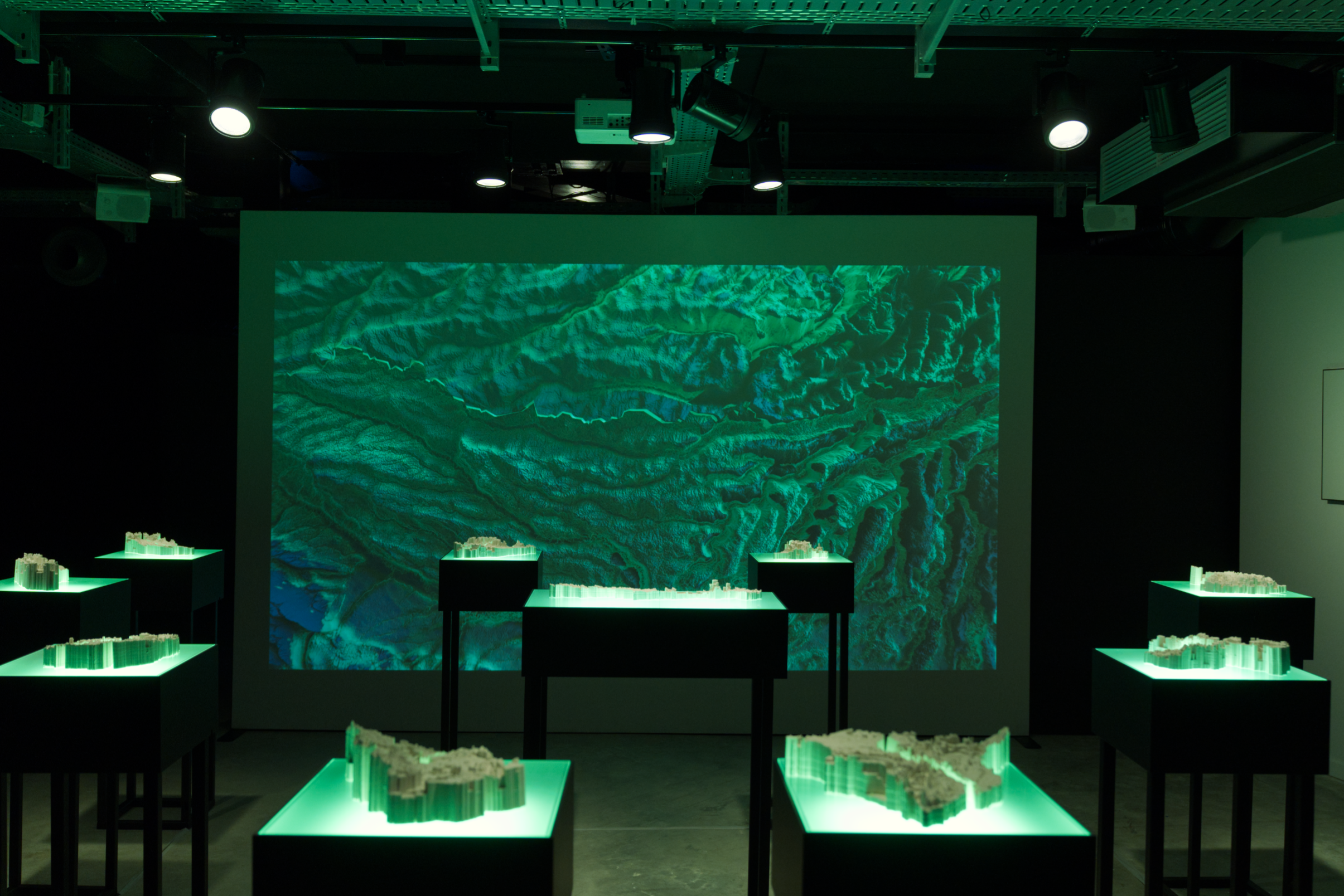
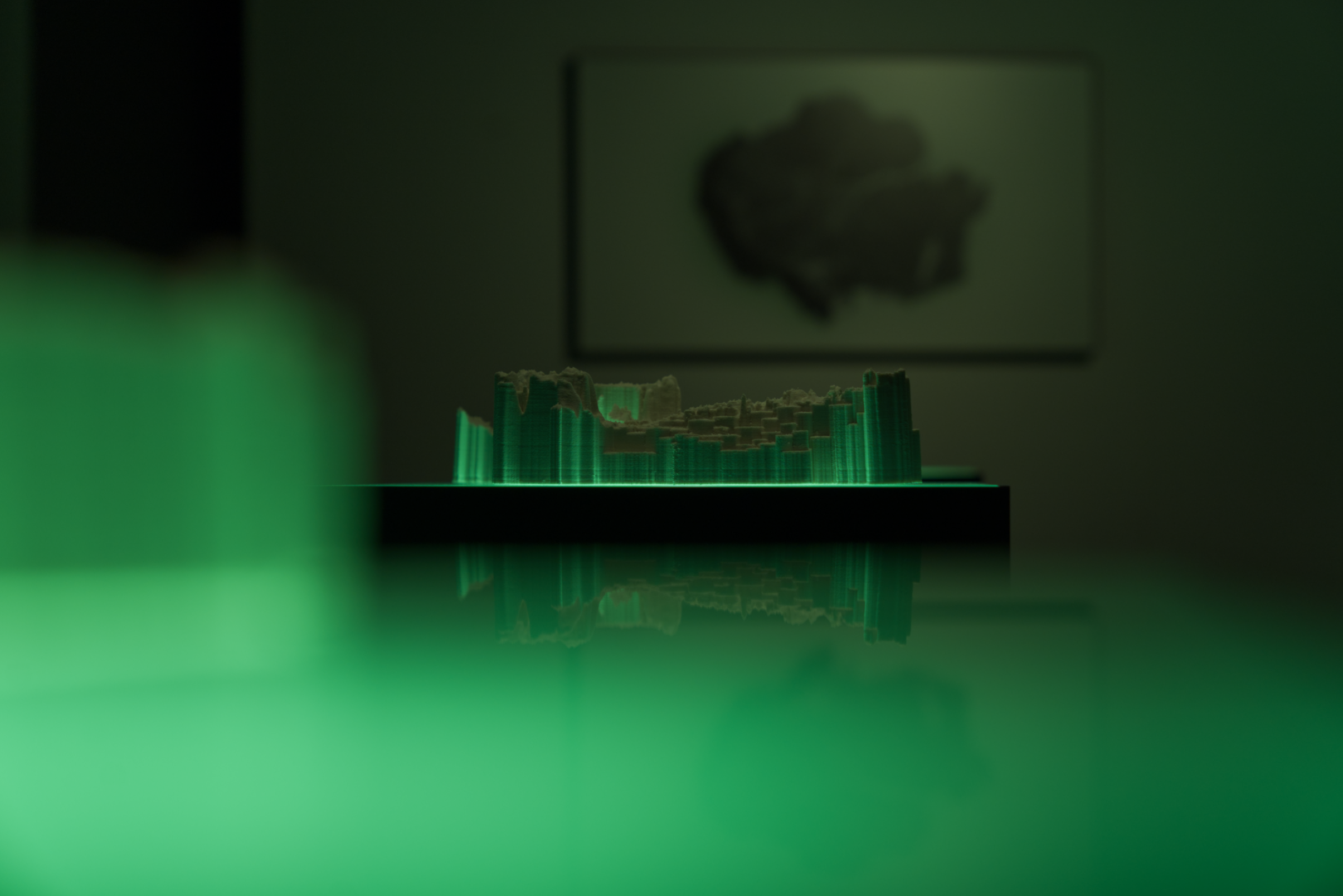
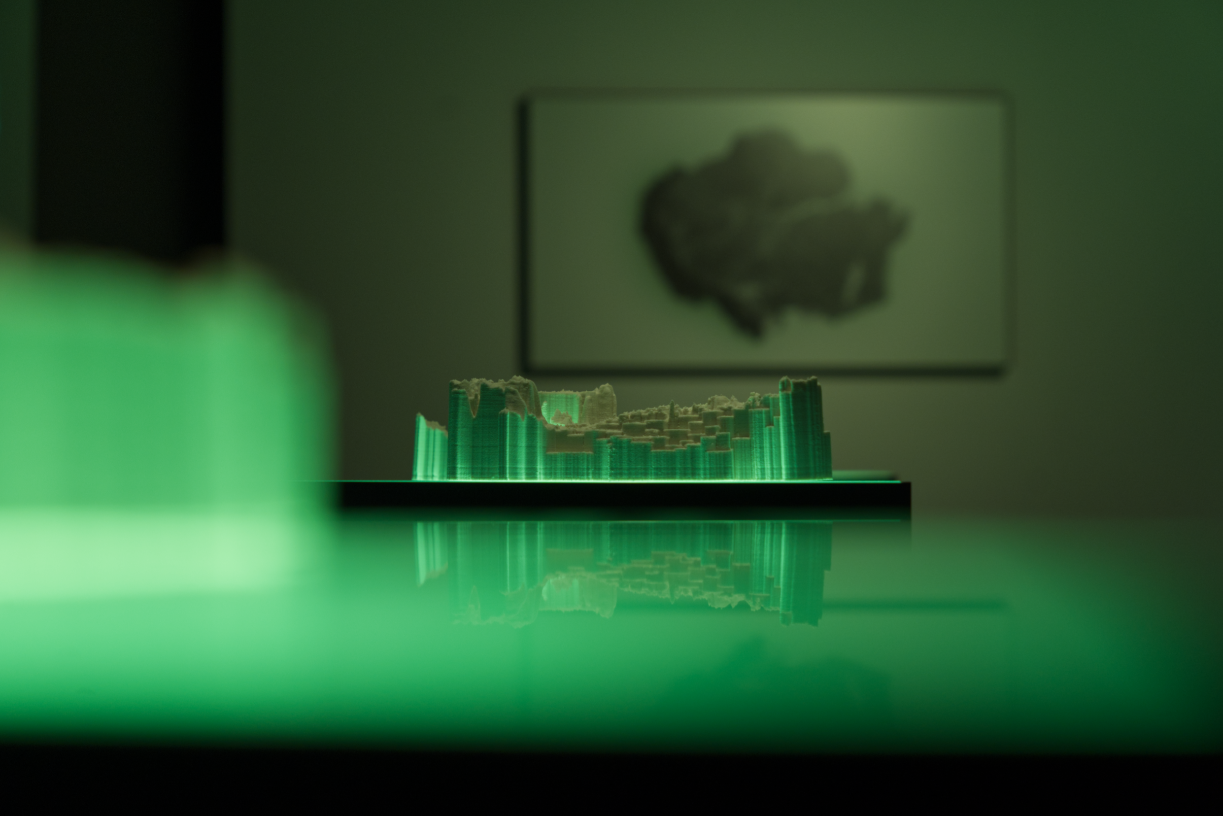
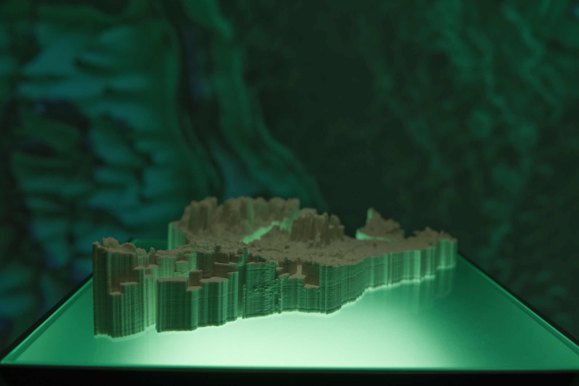
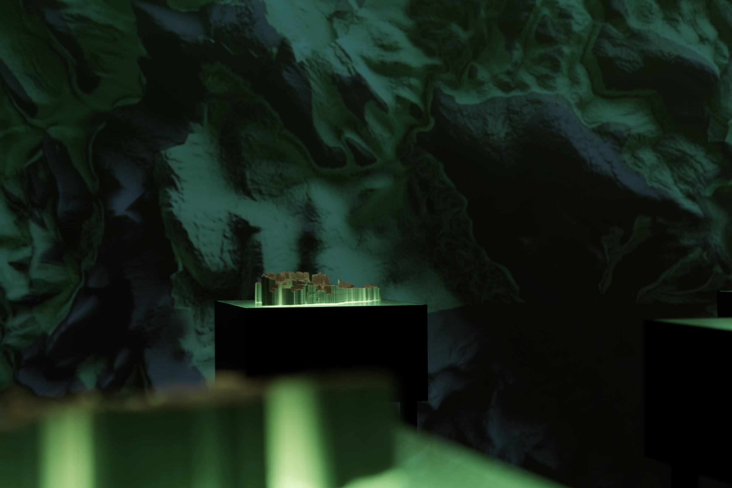
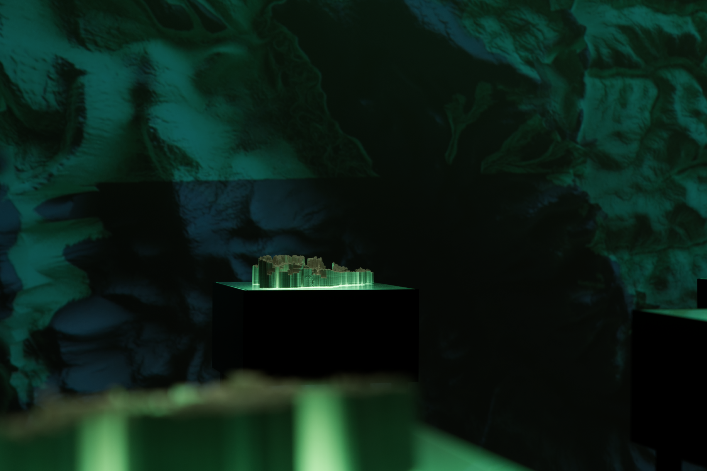
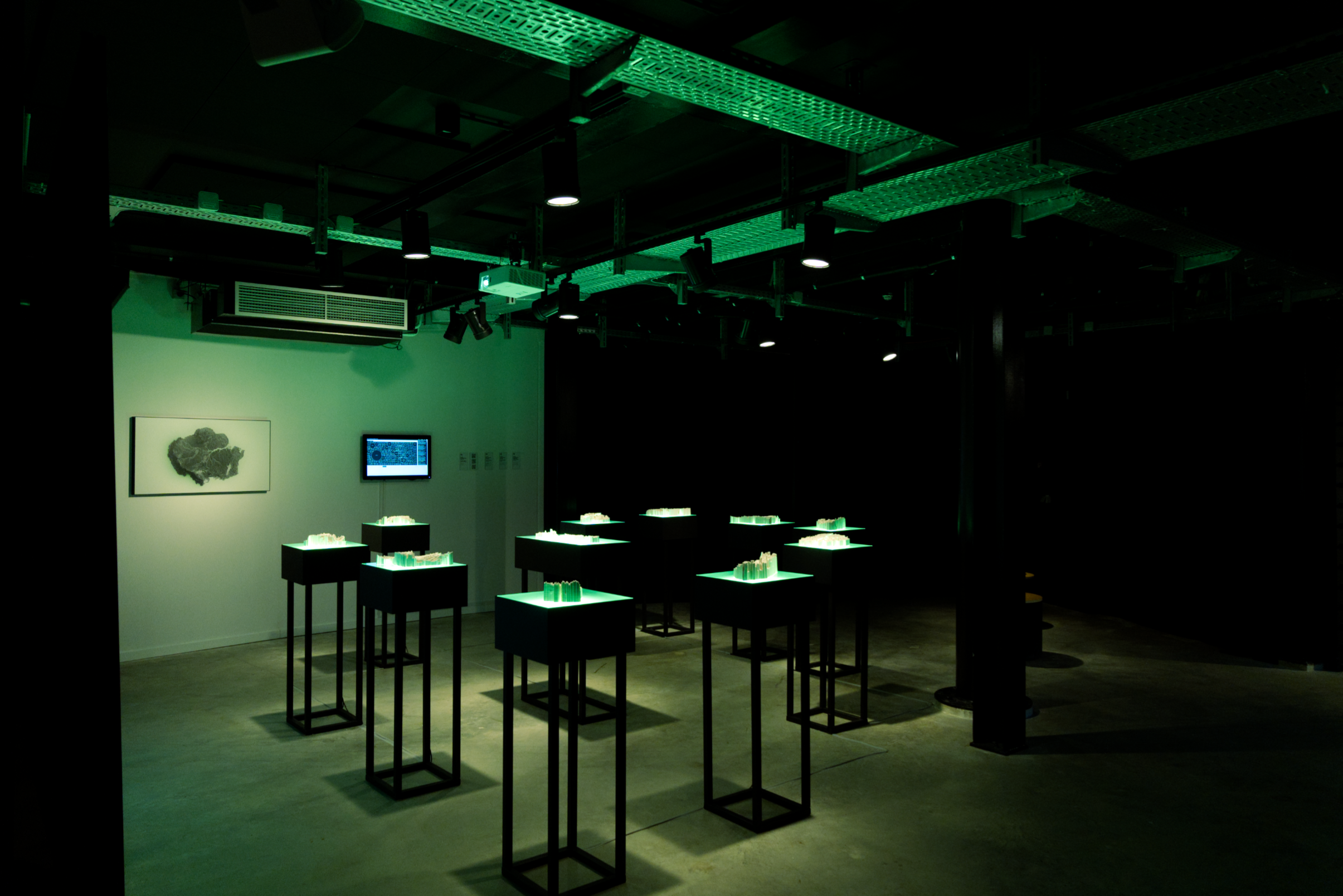
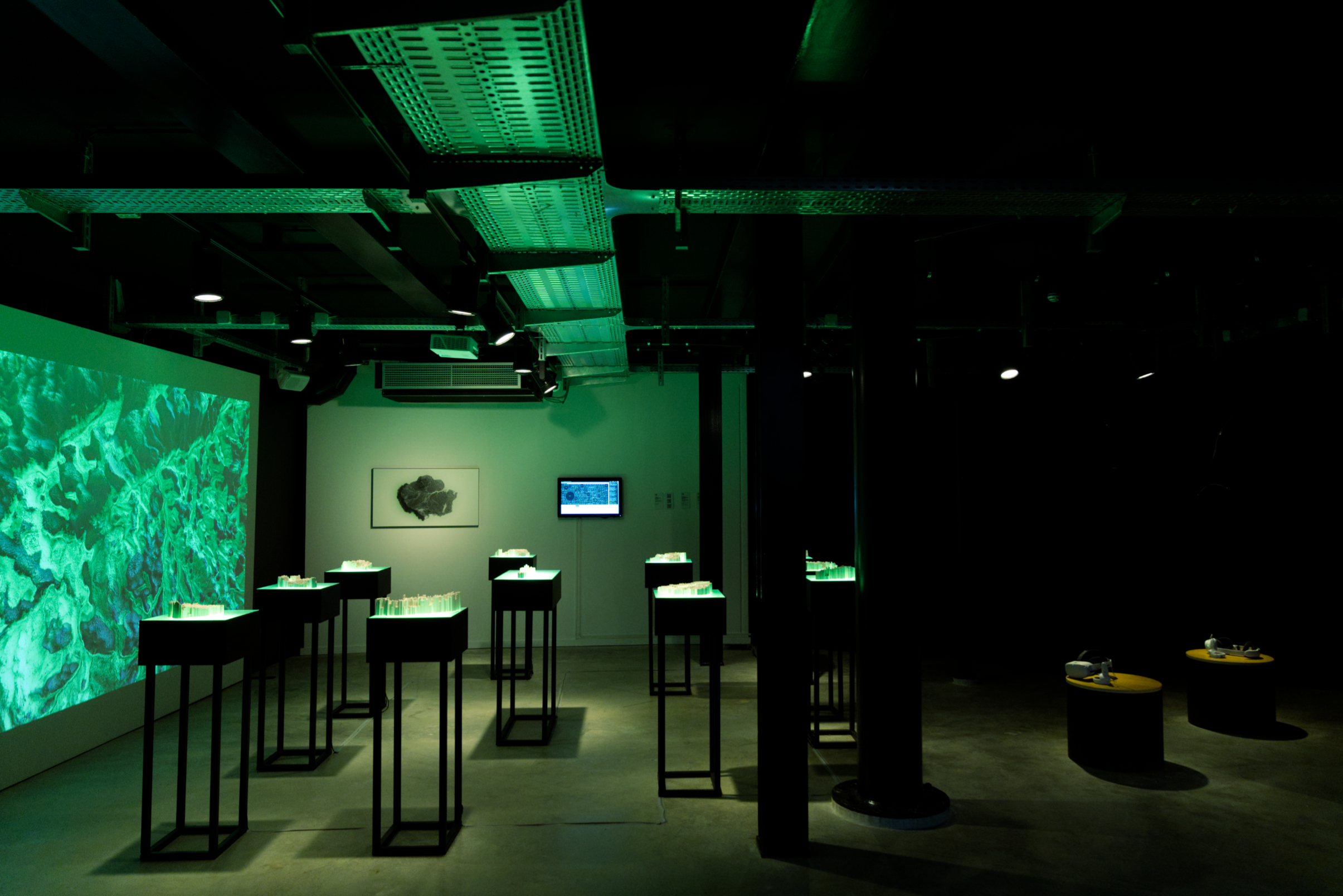
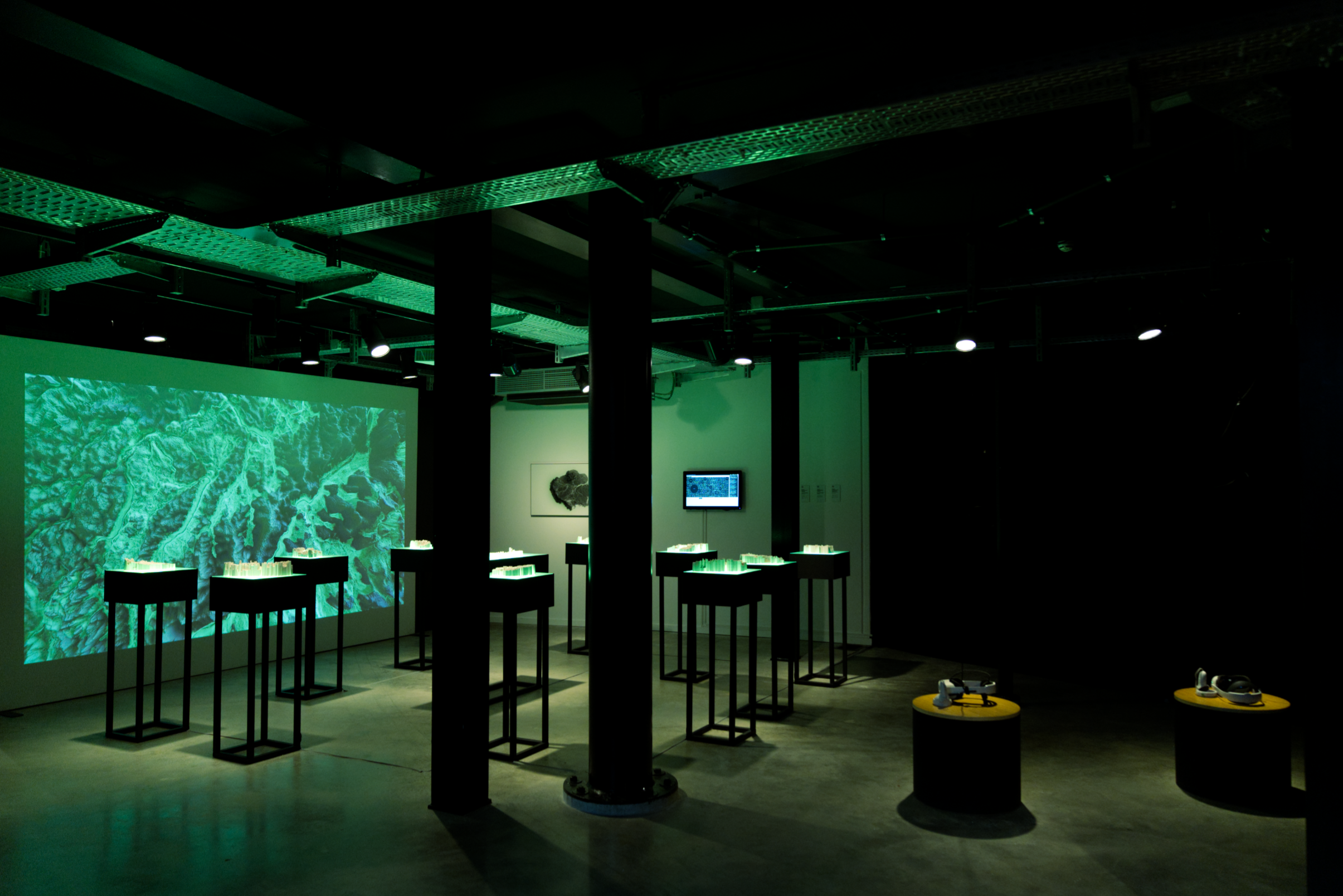
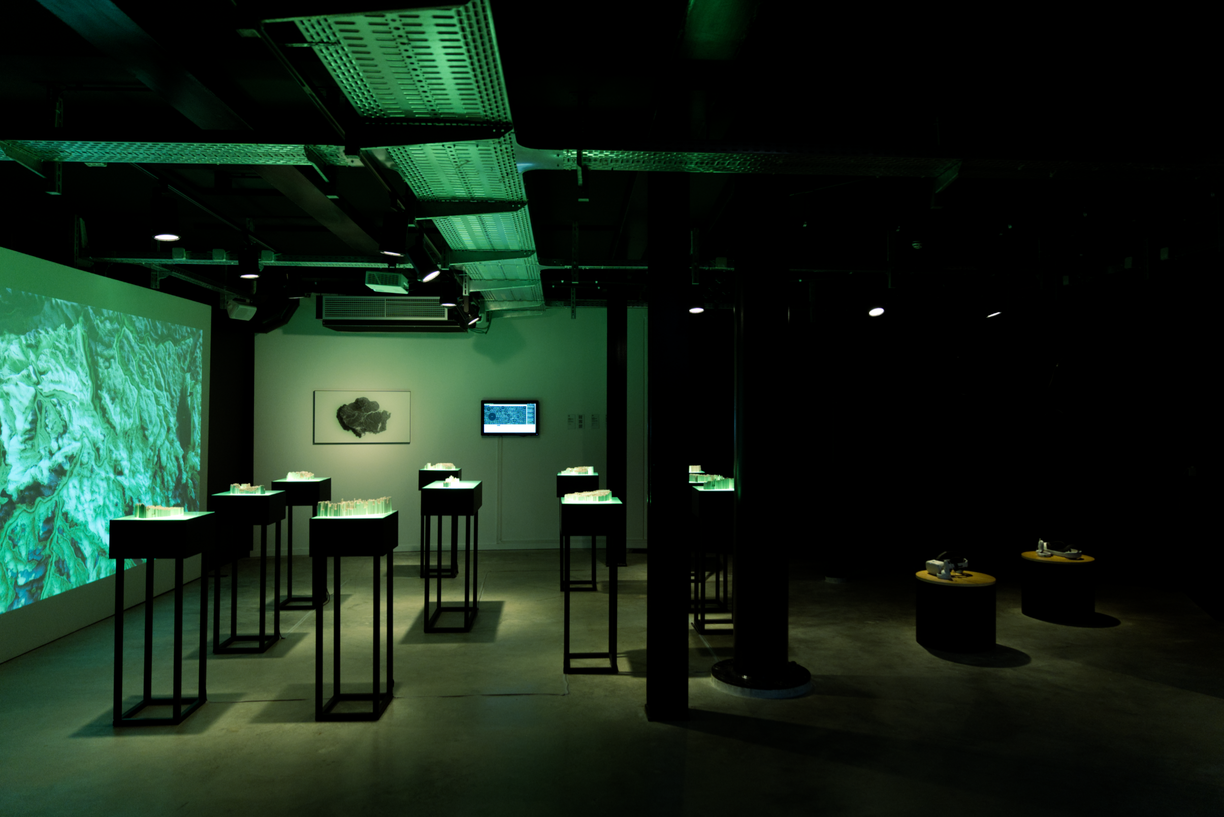
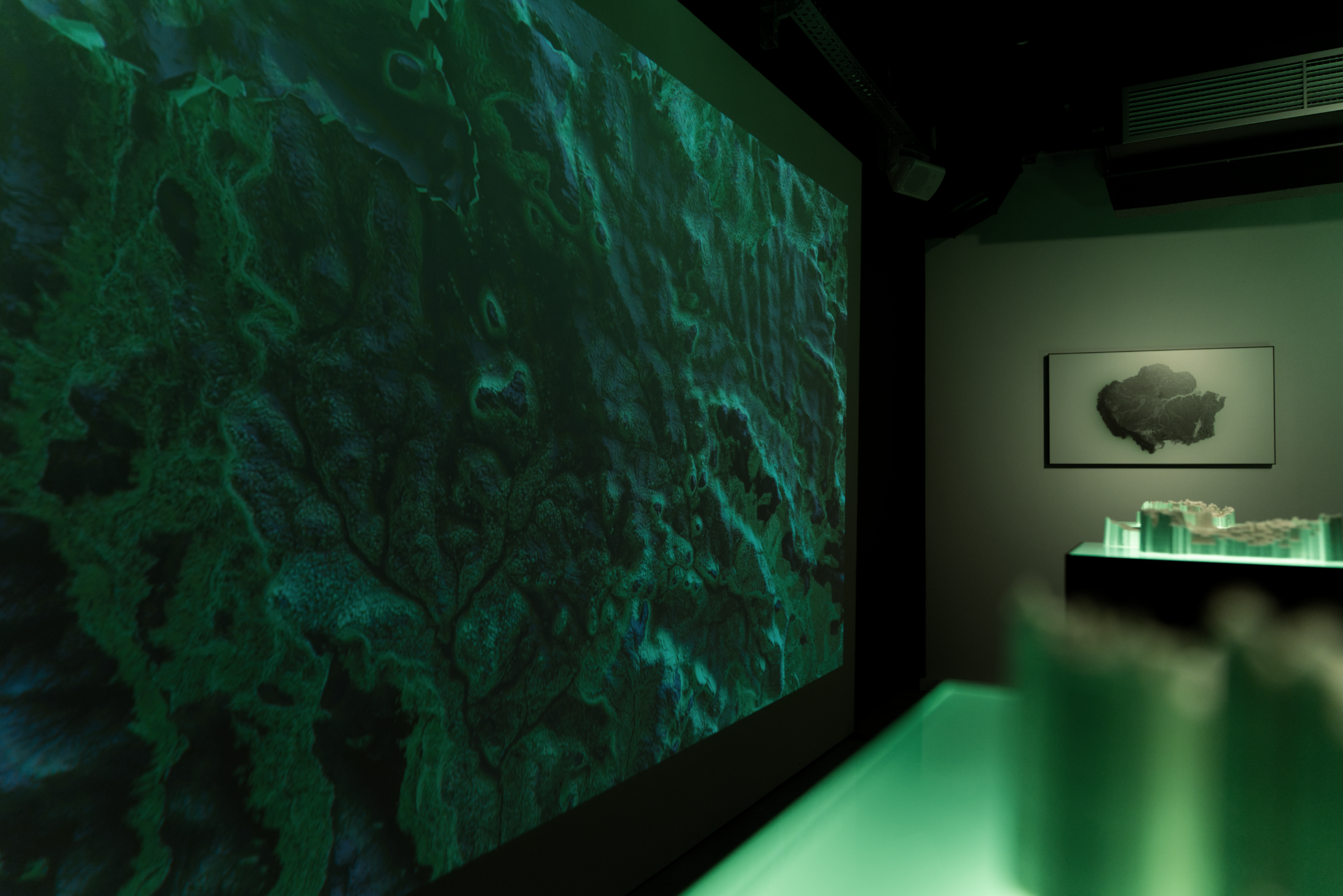
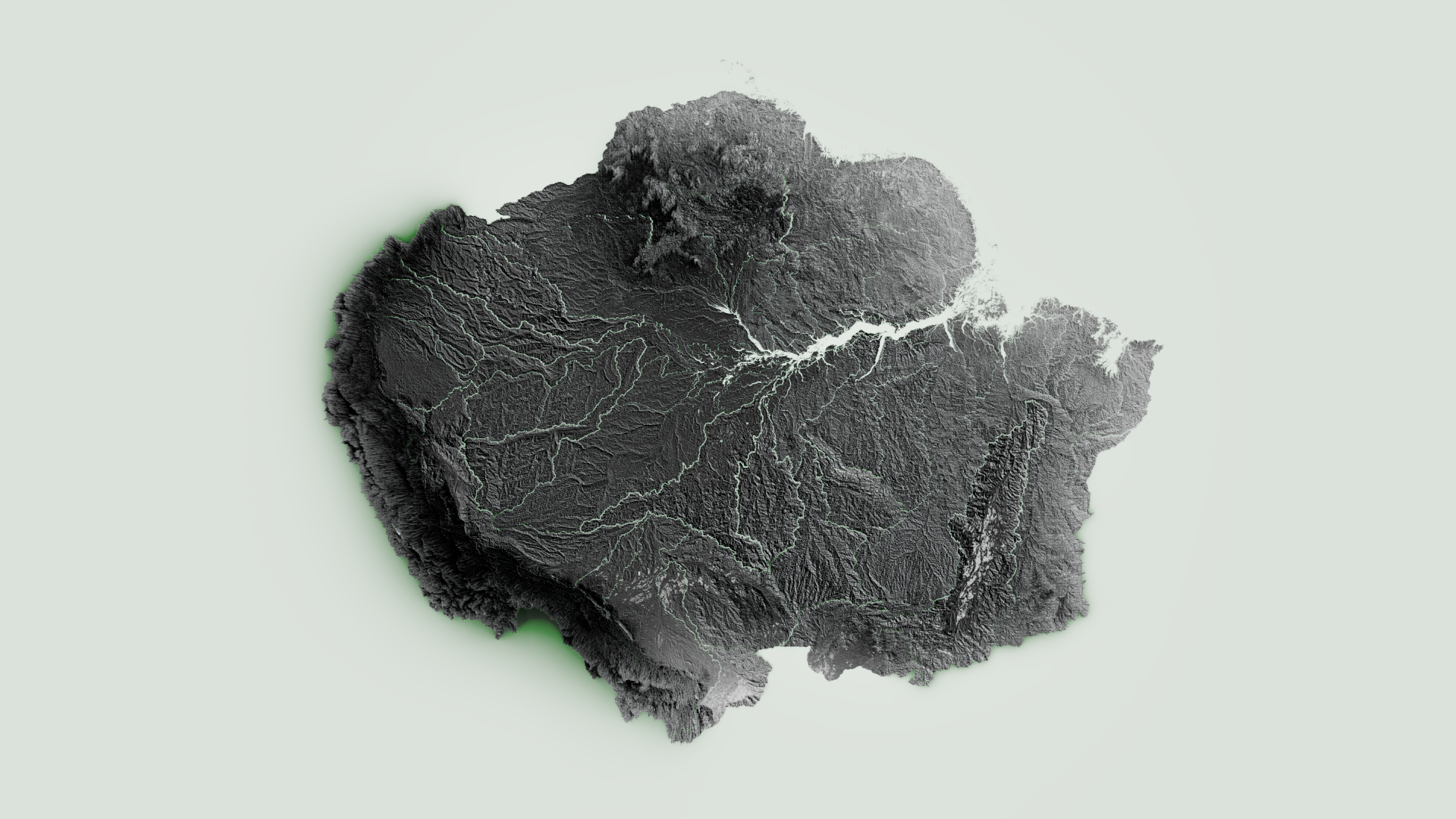
The Rios Trilogy immerses the viewer in a green-lit atmosphere featuring interconnected works related to the Amazon Basin. Twenty-one 3D-printed ceramic topographical reliefs, based on tridimensional reproductions of the hydrological distribution of the Amazon Basin (water bodies), are placed on green-lit boxes and distributed throughout the space. LINK.
A 3D animation travelling along a raised relief map (3D topography map) of the Amazon Basin is projected onto a full wall near the ceramic pieces LINK.
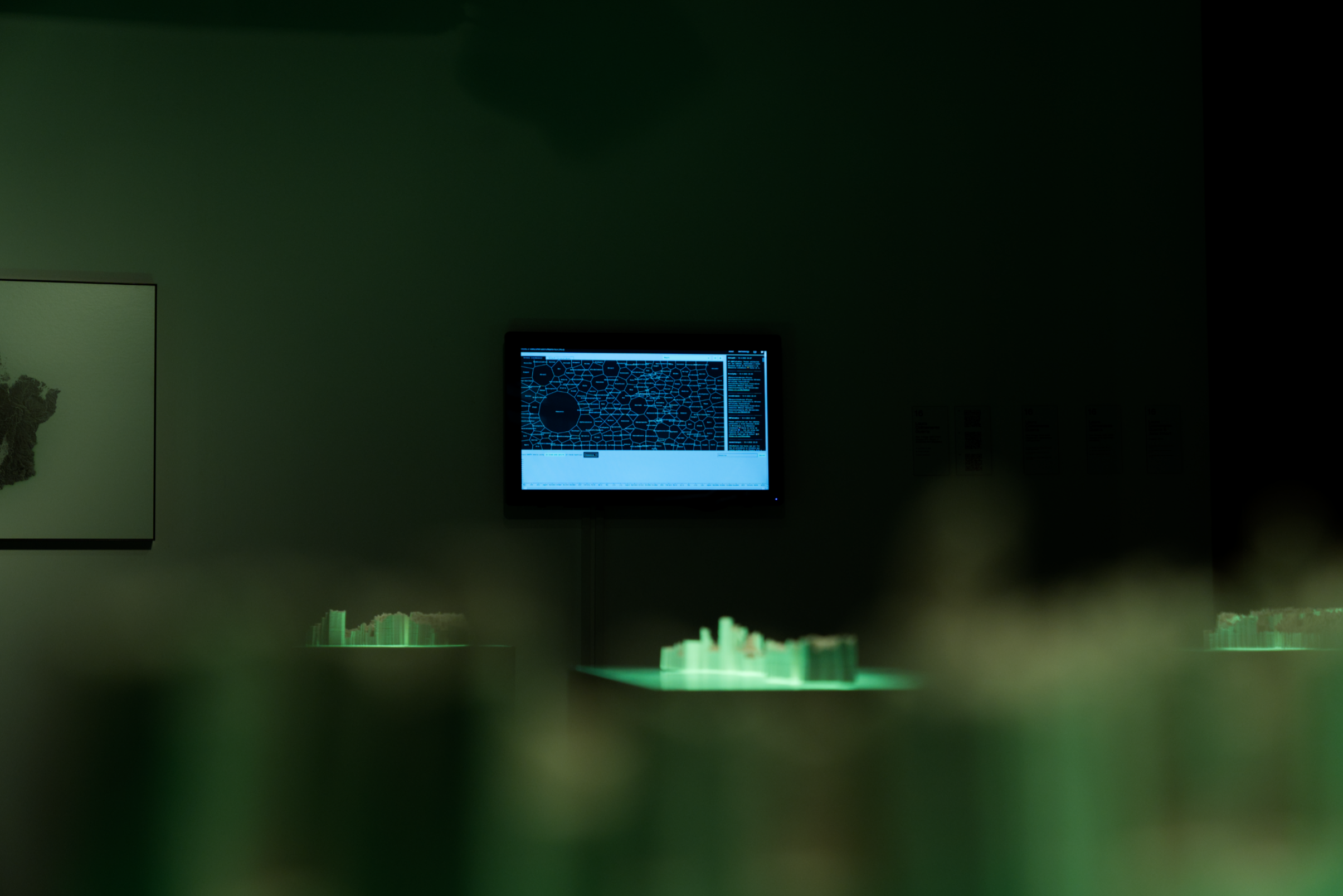
On another wall, a printed map of the Amazon is mounted next to a touchscreen, which allows viewers to explore an experimental graphical research tool mapping Twitter-related information about the Amazon Rainforest. This tool is an archive of Twitter data from before Elon Musk acquired the platform LINK.
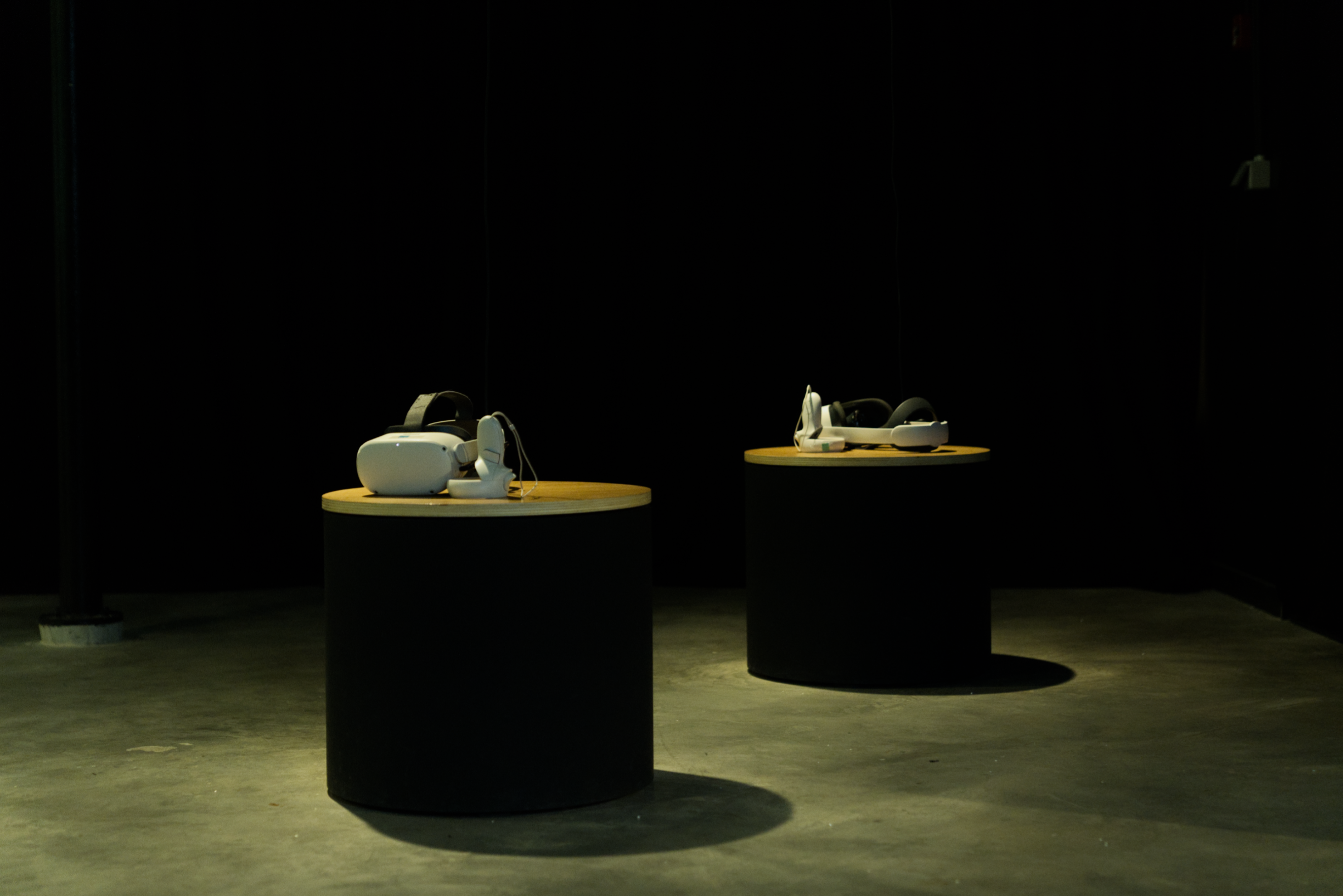
Two rotating chairs positioned near the sculptural installation allow viewers to navigate a Virtual Reality piece, R€¥€R$€ (REVERSE) LINK.
R€¥€R$€ immerses viewers in the complex realities of Amazonia, where human, cultural, and environmental crises intersect with power, economics, and multinational interests. In the context of climate stress, the work emphasises the vital importance of preserving this unique ecosystem for the survival of life (as we know it) on Earth.
The VR environment is connected to the 3D-printed ceramic pieces. Both the physical and virtual worlds explore the Amazon's map through hydrological divisions (instead of political boundaries). While the physical ceramic sculptures archive, in their bodies, a crucial moment for the diverse ecosystems forming the Amazon basin, the virtual world (VR) allows visitors to interact in real-time with the social and environmental problematics.
Through the VR interaction, visitors can select individual territories from the virtual map, manipulate them in 3D space, and trigger layers such as Indigenous Territories and Natural Protected Areas. In parallel, by rotating the physical chair, the visitor navigates through versions of the map that highlight environmental threats, including oil and gas extraction, legal and illegal mining, fire zones, hydroelectric energy, road infrastructure, and deforestation.
To create both the 3D-printed ceramic sculptures and the interactive maps featured in the VR environment, we used Digital Elevation Models (DEMs) to reconstruct topography in three dimensions, along with hydrological and territorial analyses that informed the hybrid visualisations presented throughout the project. All the socio-environmental layers are based on open GIS data from RAISG (https://www.raisg.org/). We processed this geospatial information through a range of geospatial tools. We experimented with various methods to interpret the data and use it for the creation of both physical and virtual objects.
The Amazon is the world's largest and most diverse rainforest, with 670 million hectares of forest and 100 million hectares of freshwater ecosystems. It covers 7.8 million square kilometres and 44 per cent of South America. Amazonia is home to 33 million people and thousands of species. The Amazon Basin Rainforest plays a crucial role in mitigating the effects of climate change, balancing the climate, distributing rainfall, and capturing massive amounts of carbon dioxide (CO2). However, the management of the Amazon Basin as a whole is limited due to the differing public policies defined by the nine countries it spans across, hindering cooperation mechanisms.
There is a persistent view of Amazonia as a remote territory able to provide endless natural resources. At a national level, the Amazon Rainforest is viewed as a territory capable of ensuring energy sovereignty and a source of income based on the production and commercialisation of raw materials. On a global scale, the region provides significant quantities of commodities while also being recognised as the most important source of fresh water and biodiversity, as a regulator of the Planet's climate, and as a carbon sink for large quantities of greenhouse gases.
More than half of the Amazon region, 66%, is subject to permanent or ongoing pressure due to human extractive practices such as oil and mineral exploitation, road infrastructure development, ranching, agricultural activity, and hydroelectric plants. Deforestation, burning, and loss of carbon stocks are proof of the large-scale transformations taking place in Amazonia.
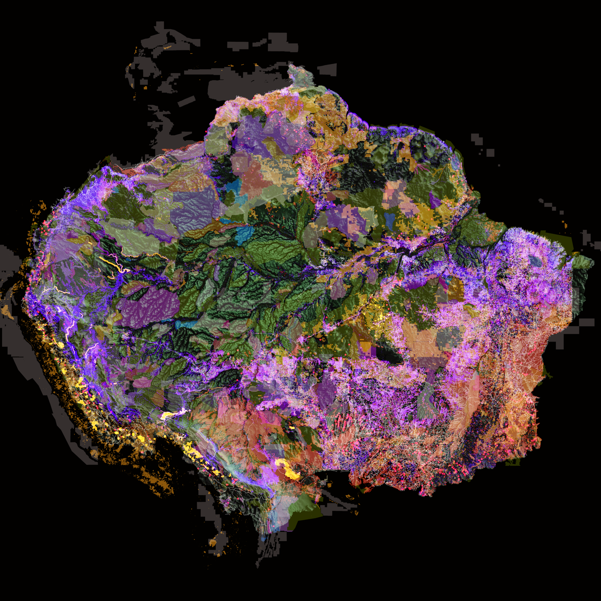
This map merges Indigenous Territories and Natural Protected Areas with deforestation, oil blocks, legal and illegal mining, hydroelectric plants, road infrastructure and fired zones.
Credits
- Conception, direction, production: Laura Colmenares Guerra
- GIS analyst: Gabriel Codreanu
- GIS Data: RAISG (Amazon Network of Georeferenced Socio-Environmental Information)
- Rivers//Amazonia geo-linguistics software: Gijs de Heij
- Ceramics3D printing: Laura Colmenares Guerra
- 3D sculpting: Geert Melis
- Unreal environment & lighting: Samson Michel
- Animation & compositing: Laura Colmenares Guerra
- CG & VFX supervisor: Laura Colmenares Guerra
- Unreal developer: François Zajéga
- Additional Unreal development: Slappy Inc.
- Sound design & Music composition: Loup Mormont
- Amazon sound field recordings: Jana Irmert & Laura Colmenares Guerra
- Text editor, Camilla Colombo
- Studio recordings, Antonin Simon
- English VO, Emma Dingwall
- French VO, Sarah Hebborn
- Dutch VO, Nina Mallants
- Portuguese VO, Fernanda Stefanski
- Spanish VO, Laura Colmenares Guerra
- Text corrections and translations: Anne Vereecken / Natalia Valencia Arango / Ellie McDonald / Nina Mallants / Santiago Colmenares Guerra
- Wood constructions: Chris Lecler
- Porcelain advisor: Eve Vaucheret
- Metal Constructions: Julie Van Mechelen
- R€¥€R$€ is coproduced by OHME
- Agent: Ischa Tallieu