Ríos-Scopitone
RÍOS // CHAPTER IIThe Ríos Trilogy is an installation project based on the Amazon Rainforest territory, understood from a local and global perspective. The project explores the relationship between language and the construction and definitions of territory. The trilogy proposes a lecture of Amazonia based on observation and analysis of metadata - hashtags from social media, combined with actual geo-reference data related to socio-environmental threats the territory undergoes.
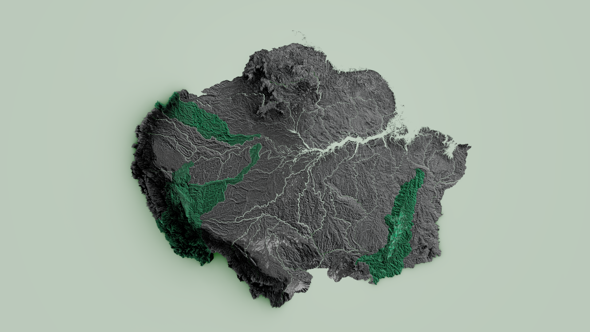
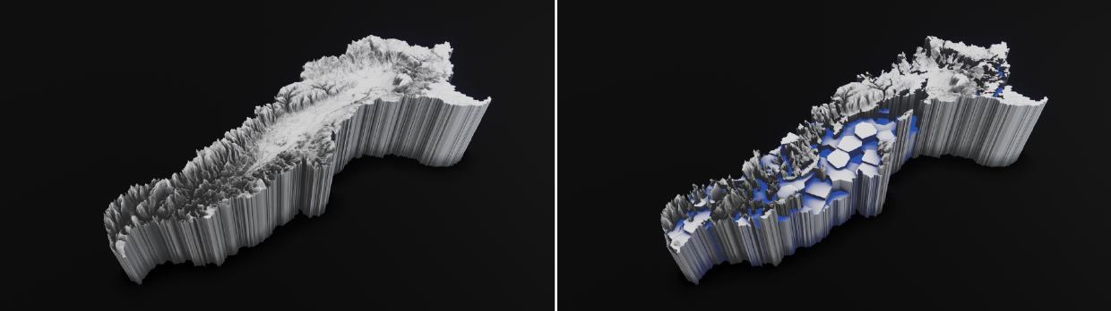
RÍOS // chapter II proposes a series of speculative cartographies that rise from a digital process of hybridisation of Amazonia related data. The cartographical work produced in Ríos results in a series of nineteen sculptures. Each sculpture is based on topographic data from a territory delimited by the hydrological sub-basins forming the extensive Amazonian basin and the major tributary rivers nourishing the Amazons River:
Japurá-Caquetá / Iça-Putumayo + Napo + Nanay / Marañon + Huallaga / Javari + Jutaí / Ucayali / Juruá / Purus + Tefé / Madre de Díos + Beni / Mamoré + Guaporé / Madeira + Aripuanã / Juruena + São Manoel + Abacaxis + Tapajós / Iriri + Xingu / Araguaia / Tocantins / Mearim / Trombetas + Jari / Branco / Negro / Amazon floodplain
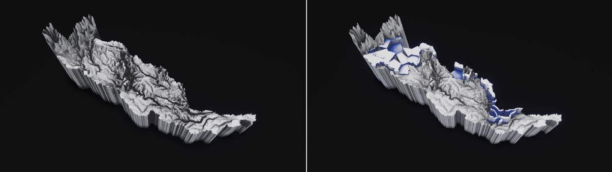
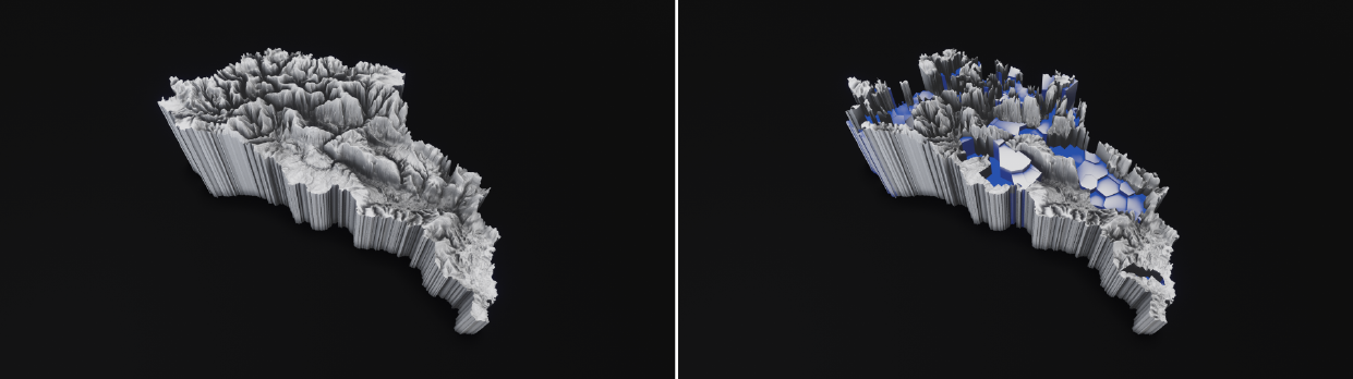
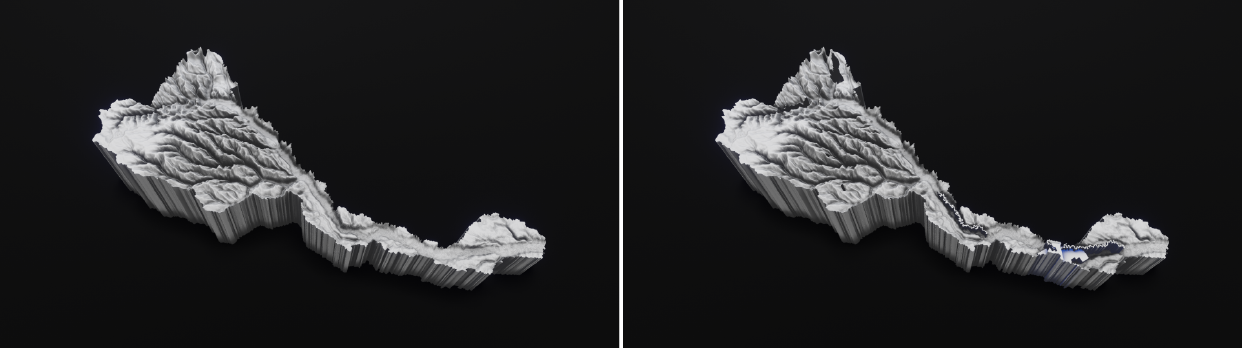
Each sculpture is based on digital elevation models that result from the process of combining:
a) Actual topographic data.
b) Geo-referenced information related to socio-environmental threats.
c) Linguistic analysis based on RIVERS // AMAZONIA geo-linguistics: https://rivers.ulara.org/
Highlighted on green, the four (4) sculptures present at the Festival Stereolux/Scopitone, correspond to the following Amazonian subbasins:
Japurá-Caquetá / Ucayali / Juruá / Araguaia --- (Follow the links for information on each territory)
The sculptures are archaeological pieces that archive a historical moment of the Amazons: they record the state of the socio-environmental problems of the territory. In parallel, they archive the semantic relationships generated around these issues on social networks.
For this purpose, we are using statistical data and geospatial socio-environmental information formulated by the RAISG (Amazon Geo-Referenced Socio-Environmental Information Network) that works by mapping the advancement of these threats and the pressures that the region faces. The main threats connecting the ecological and social damage infringed to Amazonia by human extractivist practices include:
The construction of water dams, the extraction of metals and minerals from the soil and the rivers, oil and gas extraction, deforestation of the rainforest to accommodate cattle (beef and leather) and support the production of soy, palm oil and timber.
The geo-referenced information is combined with linguistic analysis performed by the online application Rivers//Amazonia geo-linguistics.
The process includes a temporal procedure from December 2020 to December 2021. During this period, we create "Time Stamps" which are used to modify the topography of the Amazon according to the procedures described above. (See chapter I: RIVERS // AMAZONIA geo-linguistics online application)
The digital elevation models are used to generate volumetric cartographic representations, resulting in 3D models. The 3D models are printed with the assistance of a 3D printer using clay (porcelain) as raw material.
For more information: https://ulara.org/selected-work/rios-trilogy